Overview of The Marshall Islands
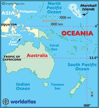
Location of The Marshall Islands
The official name of the country is actually Republic of the Marshall Islands, or RMI. And we learned pretty quickly that they do so love their acronyms in RMI. It’s located north of the equator about halfway between Australia and Hawaii, with almost all of the islands falling between 5- and 12-degrees north latitude. It has a close relationship with the United States stemming from the fact that the U.S. gained military control of the island nation from Japan back in 1944 as a result of WWII. RMI gained independence in 1979, and although they are technically a sovereign nation today, they are still tied to the U.S. through a “Compact of Association” that was established in 1986. Basically, the U.S. has full authority and responsibility for security and defense, and Marshallese citizens can work and study in the U.S. without a visa. Furthermore, the U.S. provides monetary assistance for things like health, education, and infrastructure. And as part of the compact the U.S. military gets permission to use the lagoon and several islands of the Kwajalein atoll as a missile test range facility. Stay tuned for more about Kwajalein in my next post, since that was our destination upon departure from Ailuk.
Another aspect of the Association Compact has to do with compensation and reparations for nuclear testing that the U.S. carried out in The Marshalls between 1946 and 1962. The most notable test site was the inhabited Bikini atoll. The people of the island were “temporarily” relocated, being assured that they could move back home once testing was complete, but this of course turned out not to be the case. The testing contaminated the soil and water and made the island completely unfit for supporting life. An attempt to resettle Bikini was made in the 1970s, but this was a total debacle as it still wasn’t safe and the people who moved back there developed serious health issues. Preparations for permanent resettlement began again as far back as the early 1990s, but radiation levels even today are still considered too high for permanent settlement. Additionally, since it’s been so long since the original evacuation (70 years!) it is questionable that the descendants of the original Bikini Islanders, who have been scattered across The Marshalls (and The US) for so long, will ever permanently resettle there. Today, they run a successful dive operation for tourists at Bikini, and it is supposed to be some of the most amazing diving in the world, given that the waters and wildlife have been completely undisturbed by humans all this time. Sadly, we did not make it to Bikini, however, I’ve included this information here because it’s a tragic story that most Americans don’t really know much about. If you want to learn more: https://www.bikiniatoll.com/
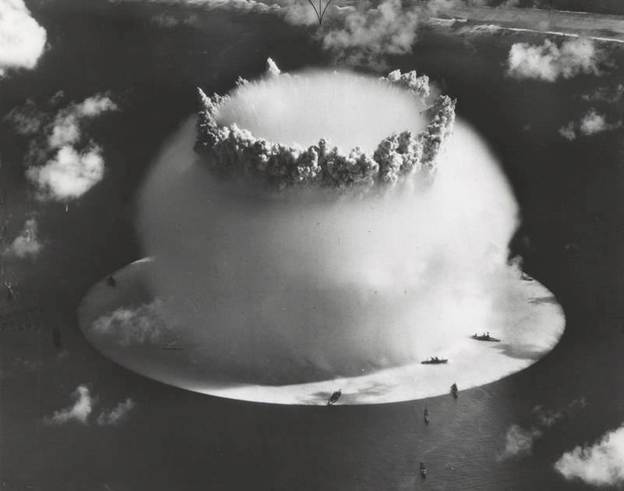
Nuclear detonation just offshore of Bikini Island
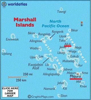
Map of The Marshall Islands (Majuro and Ailuk highlighted)
There are roughly 30 or so islands that make up RMI, and most of those are very low lying atolls nearing the end of their volcanic island life cycle. Geographically the islands lie in two parallel island chains: Ratak (Sunrise) to the east and Ralik (Sunset) to the west. Majuro and Ailuk are highlighted on the map to the right, because those are the two I will be writing about in this post, but you can also see Bikini and Kwajalein, both in the Ralik chain. The total population of RMI is about 72,000 people with most people living in the capital of Majuro, which is where our adventure in RMI began…
