Prior to leaving Mexico, I did a lot of research on the The Marquesas. I knew which islands and anchorages were on my “must see” list and I knew what the best route should be given the predominantly ESE trade winds. However, when it got close to leave The Marquesas, I was still pretty clueless about the Tuamotus. The options were endless, and it was hard to keep the names of the places straight since they were all so unfamiliar. Finally, I figured I just had to do some systematic reading, and I went through our two guidebooks and the “Soggy Paws Compendium” and made a list of each atoll along with a few other details like how easy the pass was, how big the village was, and what the fishing was like. Then I connected the atolls into logical possible routes for us through the archipelago and down the Tahiti. So, there were still a lot of options, but it was a bit more manageable, since I was able to eliminate a lot. We decided we wanted to go a little off the beaten path, but not have to transit any passes that were crazy hard. We also decided to just pick two atolls at this point, because they really are quite big, and there’s no need to rush. If we ended up with time for a third, then we would revisit our options at a later time. So, we settled on Raroia and Makemo. Raroia was listed in the guidebook as a good option for a first stop for those not wanting to go the usual route through the more northern atolls of Manihi, Ahe, and Rangiroa (the capital). We also liked the fact that it had a small village and the pass diving had been listed among the very best. Makemo caught my attention because the fishing was supposed to be exceptional, and there was no ciguatera. At one point I brought up the possibility of Kitiu, but that was shot down instantly by the rest of the gang. It has a very narrow pass, and you actually end up anchoring IN the pass, so the others thought that a little too risky. I’m usually quite conservative, but I was drawn to it by the write up of one other boat having an exceptional time interacting with the people in the village there. Oh well, there’s always next time. Tahanea, the third atoll we visited, was a last-minute decision after Makemo, and to be honest, I don’t even remember how that decision came about.
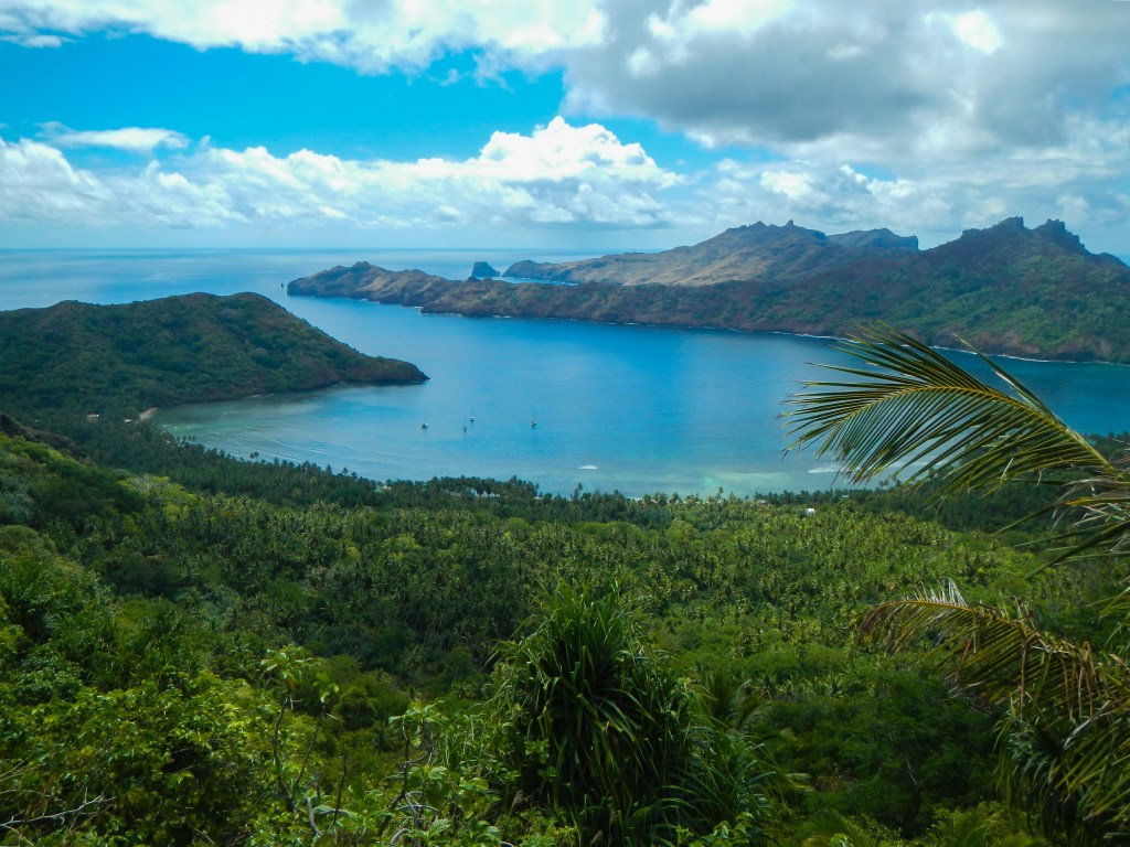
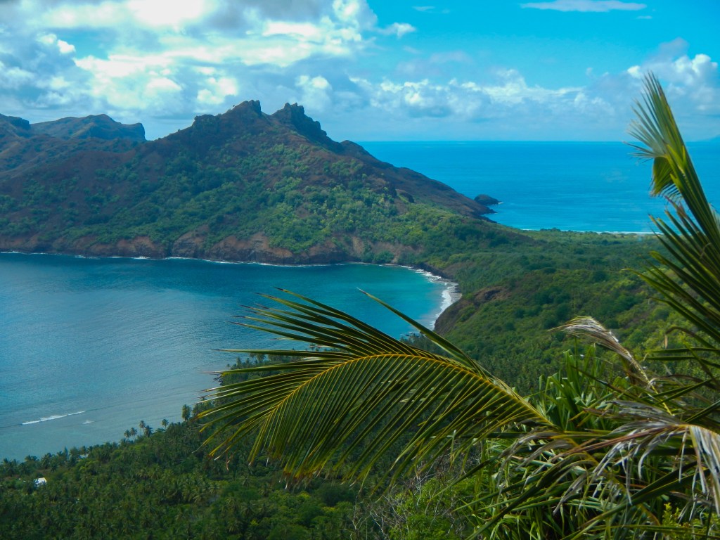
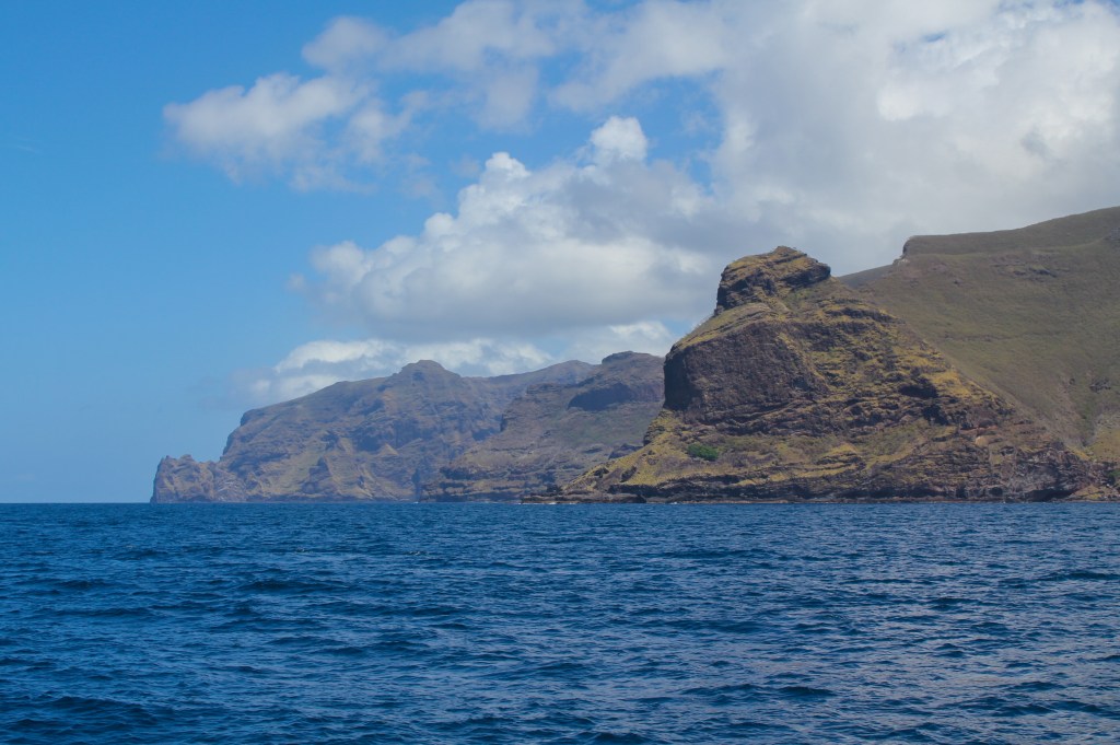
Between The Marquesas and The Society Islands (where Tahiti is) is an archipelago of over 70 small, scattered islands. Called The Tuamotu Archipelago, this group of islands was unofficially called “The Dangerous Archipelago” for centuries due to the high risk it posed to mariners. Unlike the young, steep, lush islands of The Marquesas, the islands in the Tuamotus are nearing the end of their geological life cycle. They are coral atolls, which are basically just a ring of coral, the fringing reef for a volcanic island long ago collapsed back into the sea. There are typically motus (or islets) along the reef on the northern and western sides, and if there are any towns or villages this is where they would be. The motus are totally flat with little vegetation except for palm trees and short grass. The southern sides of the atolls are often just bare, awash coral reefs, so, as you can imagine, they can be difficult to see visually until you are right on top of them. They don’t give off a huge radar signature, so before GPS this entire archipelago was mostly avoided by cruisers due to the risk of going aground and being stranded or worse, sinking.
Today, a small subset of the atolls have become common cruising destinations on the way from The Marquesas to Tahiti. Others, while less common, can still find 10-20 boats per season visiting them. Still, the majority are avoided either because they are way out of the route, because their passes are either nonexistent or too harrowing to consider transiting, or because they are too close to the restricted zone where the French used to do nuclear testing.
In order to get into the lagoon within the coral ring of an atoll, there must be a pass that is safe enough to transit. Before I say a little about the passes, I want to point out that some of the atolls are HUGE, like 10-20 miles long and 5-8 miles across. So, if you are like me, when you think of the word “lagoon” you are thinking of a small pool, but no, these “lagoons” are massive. The passes are basically just gaps in the coral and they come in all lengths and widths. Some atolls have more than one pass, but many have only one. As the tide rises and falls it affects the current through the passes as the lagoon fills with the incoming tide and then empties with the outgoing tide. The ideal time to transit a pass is at slack tide with little to no wind. The worst conditions would be with a strong current in one direction and a strong wind in the opposite direction, because this creates the condition of standing waves, and sometimes they can be huge and therefore quite dangerous. Among our buddy boats (and I’m sure among most other cruisers) a lot of effort and energy went into trying to predict when slack tide would be for a particular pass. We would take the tide tables for Rangiroa (The capital of The Tuamotus) and then estimate based on difference of degrees latitude and also what the prevailing weather has been like. For example, if the wind has been blowing hard from the south, the lagoon may be fuller due to water coming in over the reef, so the outgoing tide may be more predominant and slack tide in the pass would be offset from what is predicted based solely on the tide tables. In fact, we went to an atoll that never has an incoming current in the pass (but that story won’t come until we get to The Societies).
So, first we would all try to predict, then we would consternate, because of course we would all come up with different answers, then after more stewing and calculating we would reach some sort of agreement on when we thought the best time to transit the pass would be on the day we thought we might arrive. Then, we had to actually arrive at that time. That’s a trick. We learned we could predict fairly close, but nothing beats getting out the binoculars and observing the pass conditions with your own eyes to determine if you think it’s safe or not. I don’t think we ever transited a pass at exactly slack tide, and we did usually encounter small standing waves, but we never had anything close to a scary moment.
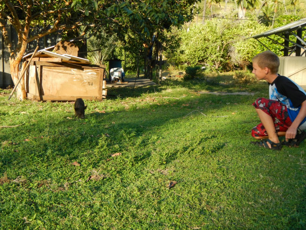
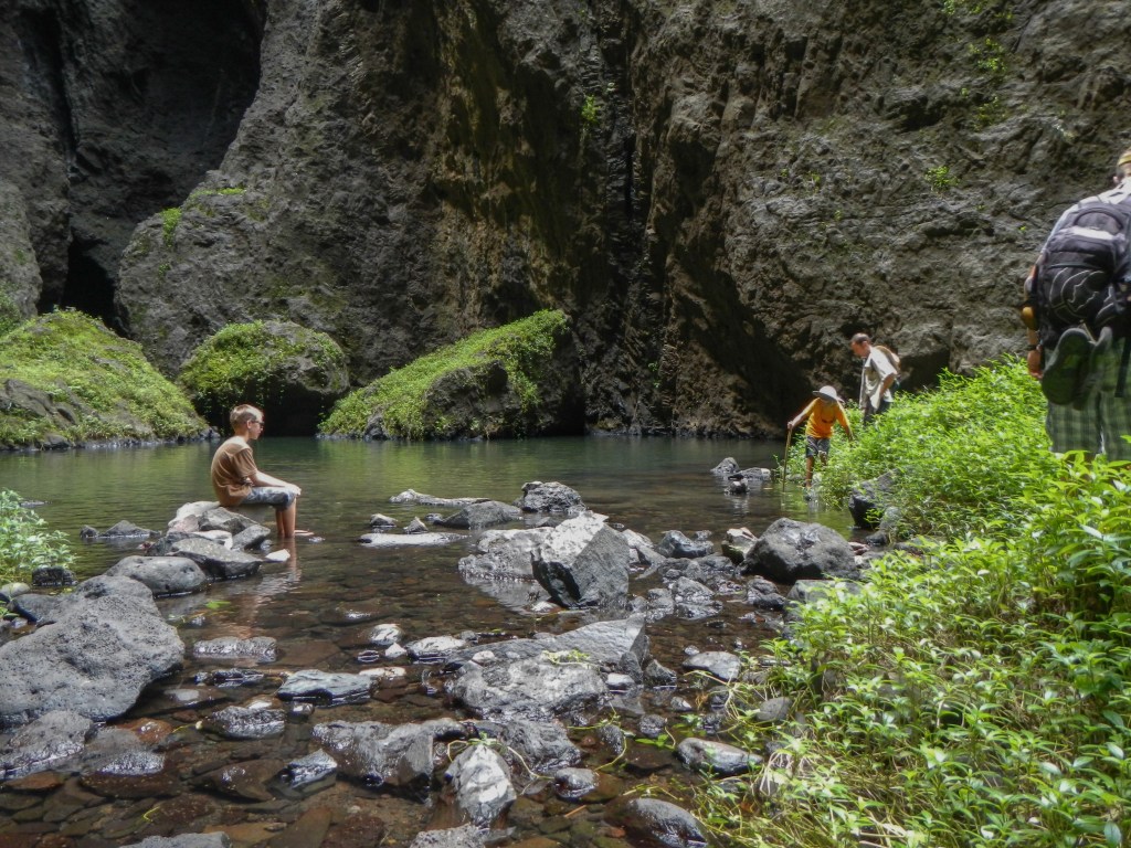
Inside the lagoons is what may at first look like a huge pool clear water to sail about as you wish without the ocean swell to roll you about. However, in reality, the lagoons are littered with coral heads, many, if not most which are not charted. So, in order to move about, you need good visibility and a constant lookout posted on the bow, or higher up, if possible. You want the sun out, not clouded over, and you want it directly overhead or slightly behind you. The worst sun condition is to have it shining directly in front of you. Generally, the coral heads, affectionately called “bombies,” are near the surface, large, and easy to spot. But you never know when that small one not right at the surface but shallower than your draft would find its way in your path, so you had to stay diligent and maintain a good watch. Alex and Brenden proved that standing on the bow watching for bombies for hours at a time was not exactly their strong suit. “C’mon Brenden! At least have your eyes pointed somewhat in the direction of the water!”
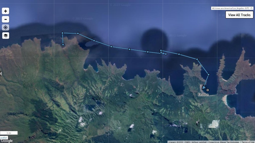
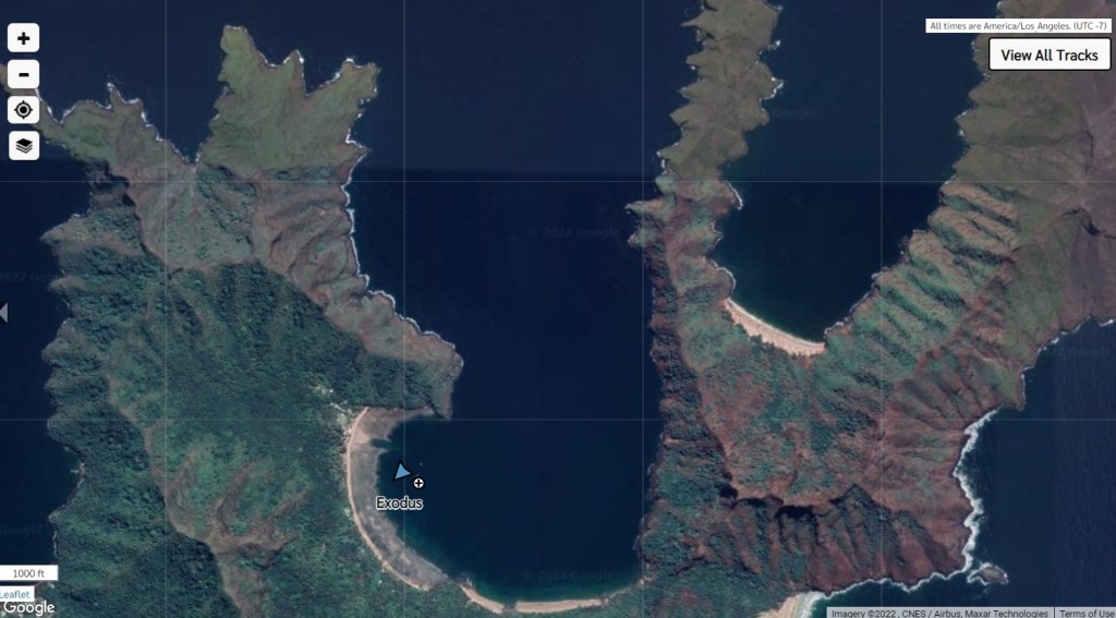
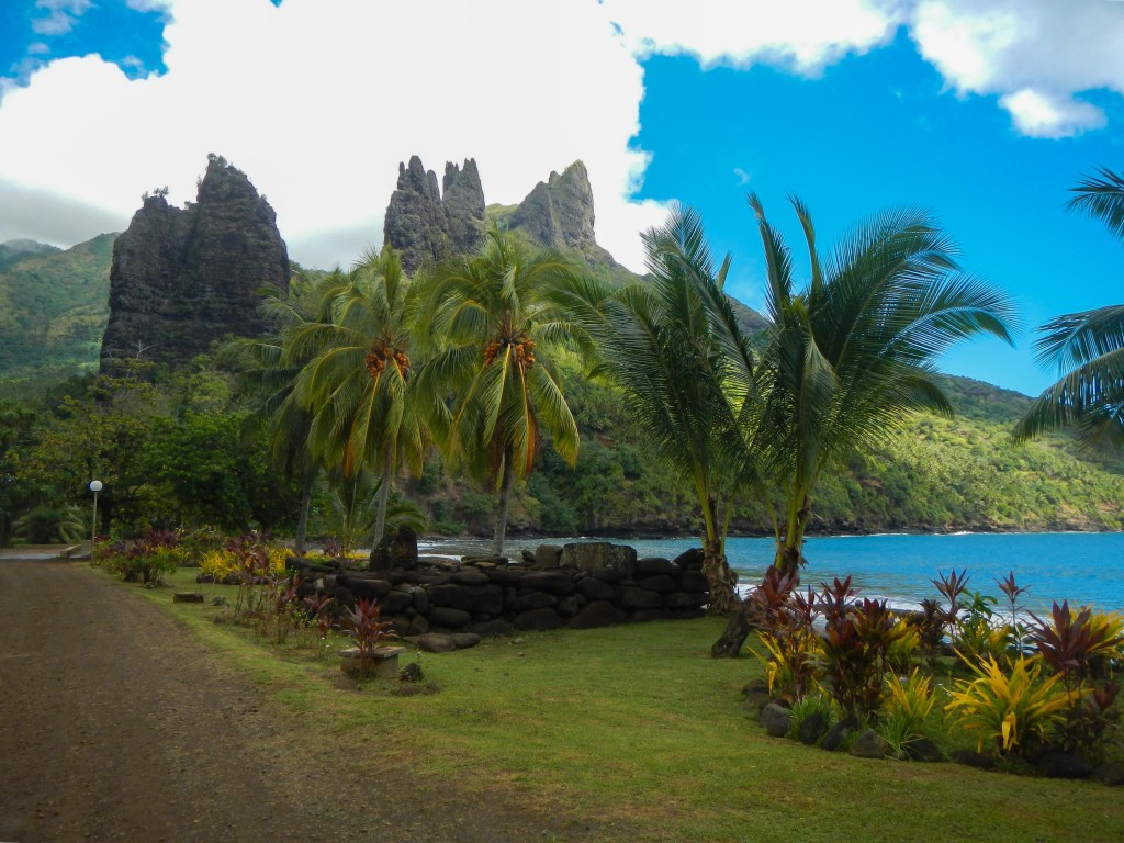
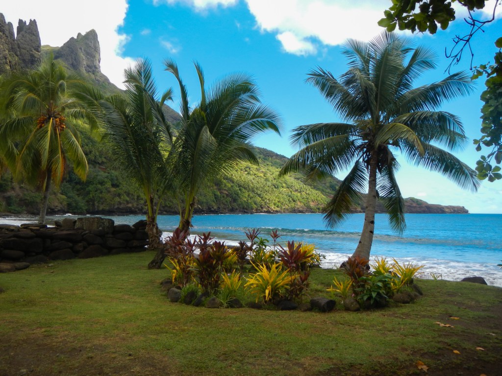
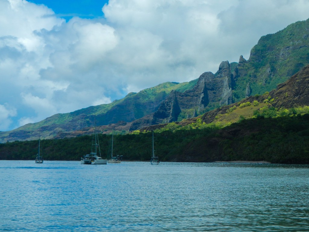
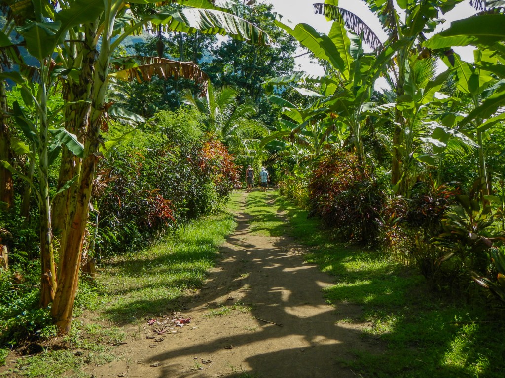
We left Anaho Bay on Nuku Hiva in the Marquesas late morning on 10 May, and we had an uncomfortable yet speedy 3-night passage down to Raroia (write-up to follow). We timed our arrival pretty well (totally lucky), and we made our way through the pass and across to the east side of the lagoon to a most spectacular anchorage. After a few nights, we moved just a bit south to yet another spectacular anchorage, but we stayed there only one night, since the weather was looking good for a pass dive, which meant moving over to west side of the lagoon near the town and the pass. We had a bit of trouble finding a suitable place to anchor, but we finally settled on the north side of the pass anchored on a bombie (a coral head) on a lee shore. Luckily, the wind cooperated and stayed under 20 kts, so we were comfortable staying there a couple nights before heading out the pass for an overnight passage to Makemo.
When we arrived in Makemo, we stern tied to the wharf at the village of Pouheva near the pass. We ended up staying there a full week, because we had so much fun with the people of the village. Afterwards, though, we spent two days at a more secluded anchorage a bit north of the village to decompress from all of our interaction. Finally, we moved near the northwest pass to do some pass diving, and once again we had a hard time finding a suitable place to anchor. It wasn’t the best anchoring situation, so we stayed only one night before leaving on a very slow overnighter to Tahanea.
We had to go intentionally slow, so we didn’t arrive to early, in fact, we were flying only a triple reefed genoa. We still arrived too early, so we waited for the sun to come up before entering the pass. Once inside, we decided that the sun wasn’t high enough to safely navigate the lagoon and all of its coral heads, so we anchored at a nice spot just inside the pass for a few hours. Later, we headed over to the southeast side of the atoll to a pleasant and protected anchorage where we hung out with a few new kid boats for a couple days. When the weather window looked right for the passage to Tahiti, we moved back to the anchorage near the pass for one night and the next morning we said good-by to The Tuamotus.
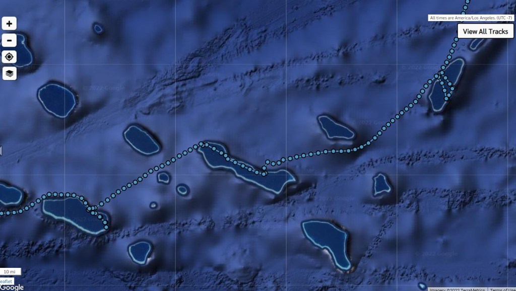
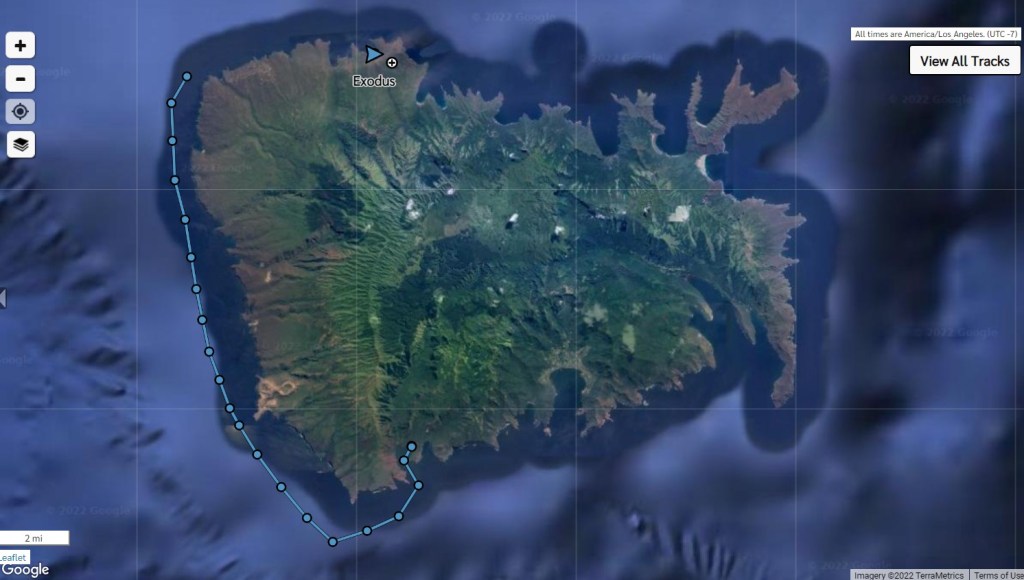
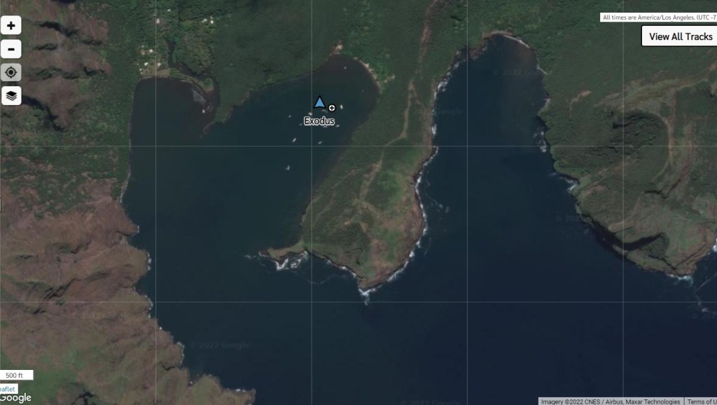
Our route through the Tuamotus – from right to left: Raroia, Makemo, Tahanea
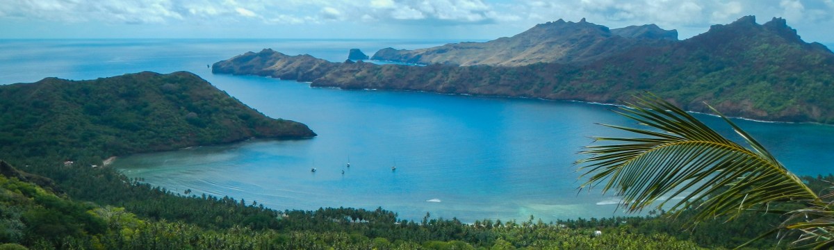
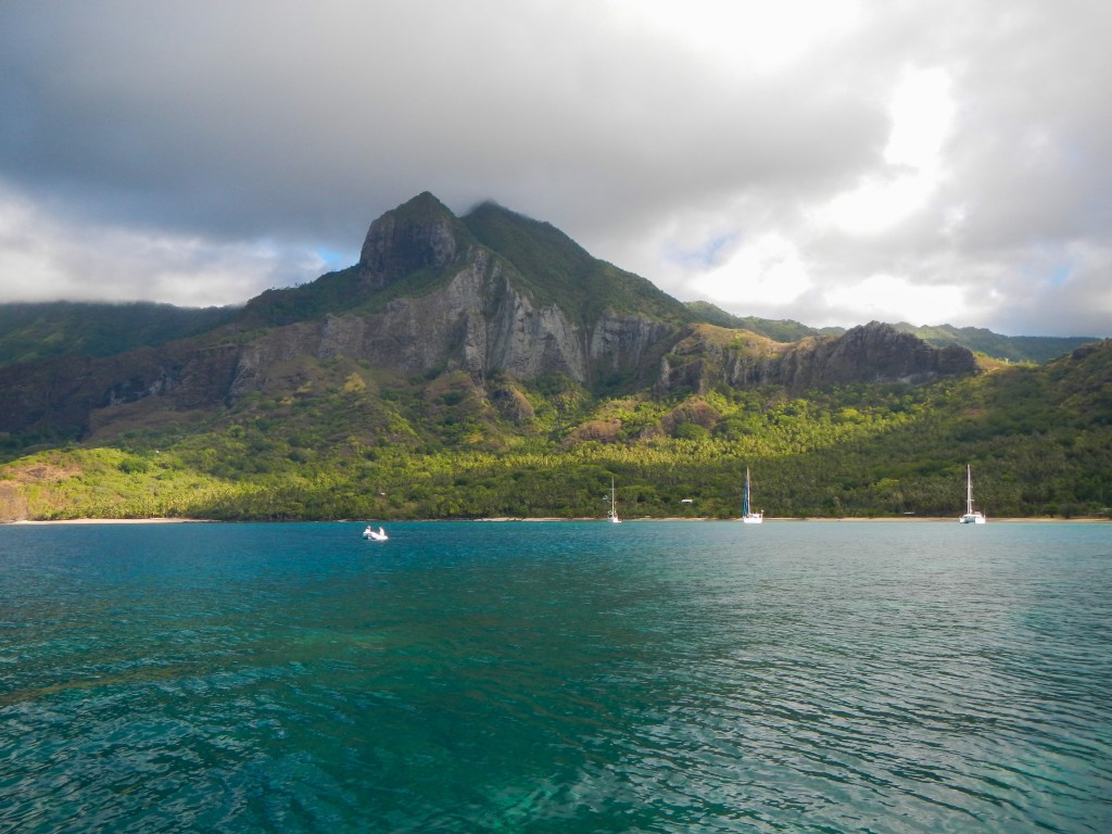
This was my second favorite anchorage in The Marquesas (after Fatu Hiva). I only regret that we saved it for last and didn’t have nearly enough time. We only have 90 days on our visa for all of French Polynesia and we were pushing 5 weeks in the Marquesas, so it was unfortunately time to go. But we did manage to hike over a ridge to the next bay to a town to buy baguettes and hike to an organic vegetable farm and pick our own veggies. We left with 4 stalks of bananas and 40+ mangoes, so we hoped to give some to the locals in the Tuamotus (spoiler alert, our first motu was Raroia and we didn’t meet any locals, so we were forced to eat all that fruit ourselves. We were on banana quota patrol.)
Logbook – May 7, 2014 (Hakaehu to Anaho)
Passage Log Highlights
1245 Arrive Anaho * No speedo
Daily Notes:
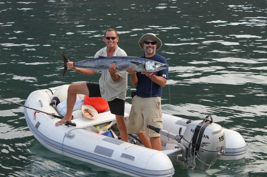
Wahoo! 49 lb 5’6”
D – paddle board along the reef. 2 turtles – beautiful
Potluck on LC. Wahoo!
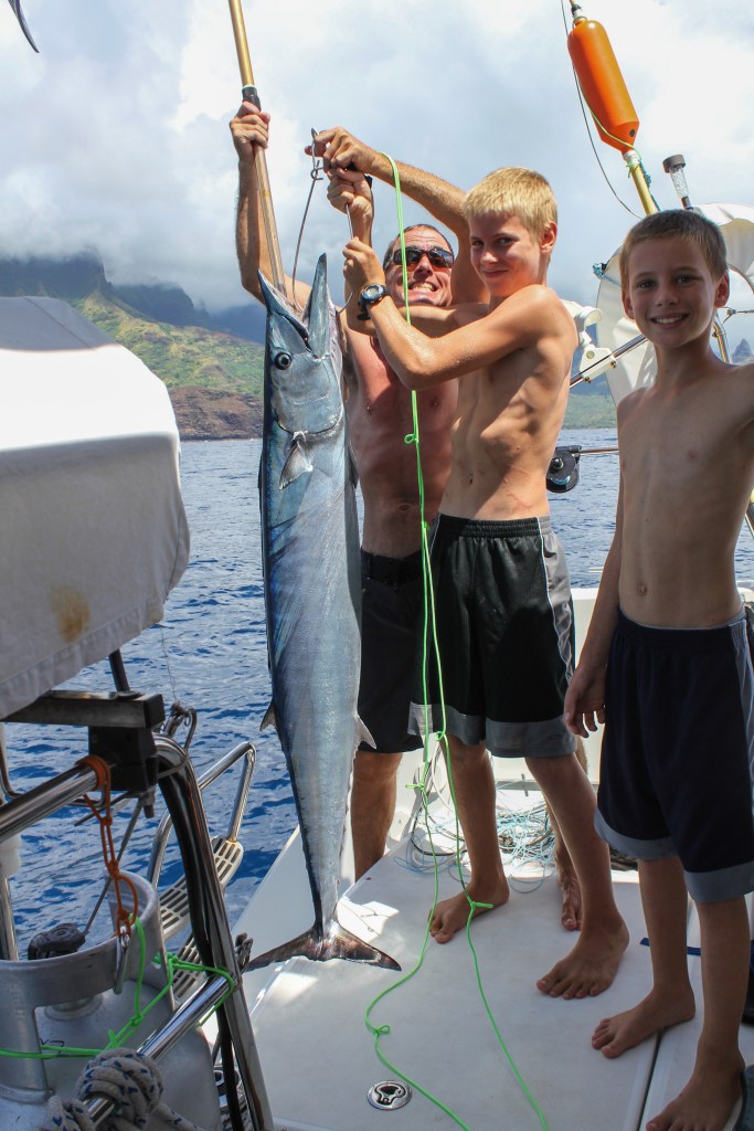
We caught a Wahoo en route. Lady Carolina was on the radio telling us about the Wahoo they just caught and that we should pull in our lines since we were set for a while and before we said “standing by” we heard, “Whirrr….” So, then we were REALLY set for fish.Depart Hakaehu May 7 at 1011 – Arrive Anaho at 1245Anaho AnchorageAnaho anchorage
Logbook – May 8, 2014 (Anaho)
Daily Notes:
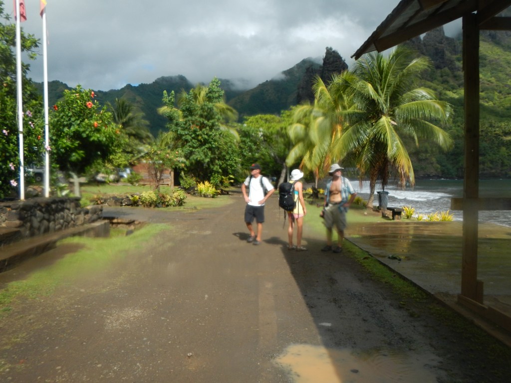
Hike over the ridge to hatiheu w/o kids. Frozen baguettes.
Rainy day
The view of Anaho from atop the ridge
Email to family and friends dated May 8, 2014
Subject: Anaho
We made it to Anaho and it’s one of the loveliest anchorages we’ve been in, well worth the bash to get here. Unfortunately it’s been raining all day today (Thursday)so we haven’t been able to fully enjoy it. We are down to just a day or two left in the Marquesas, so it’s a bit disappointing. On the 6 or so mile trip to get here from Hakaehu Lady Carolina landed a huge wahoo. We were on the radio with them, and Steve was telling us to go ahead and pull in our lines since we are set for fish for awhile and then… whrrrrr…. fish on. Tim also wrestled aboard a 5.5 ft wahoo. So, now we are REALLY set for fish. We have traded some with some locals for bananas (although the bananas have not arrived yet), traded some to another boat for some dorado, and given some away to another boat we’ve seen several times previously at other anchorage. We had a HUGE wahoo dinner on Lady Carolina last night, and we’ll be having another on Exodus tonight. Tim, Steve, Carolina, and I went on a hike this morning (sans kids) up over a ridge to the next bay where there is a town and we heard you can get baguettes there. It was a long hike, and I enjoyed it because it gave me that same feeling I get from running (getting the heart rate a little bit up and then just pushing along). We scored some baguettes but they were frozen and since it was such a small town we tempered our desire to buy 8 each and cut it down to 4 each. We will likely leave for the Tuamotus on Saturday and we will hook up again with True Blue V for the passage, so we will be convoy of 3. Chara is already in the Tuamotus but hopefully we will catch up to them in Tahiti if not before. Love and miss you all,
-D.
At 5/6/2014 3:25 PM (utc) our position was 08°49.34’S 140°03.89’W <—- just noticed the date and time are wrong. Not sure why… it’s currently Th May 8 4:50 pm Marquesan time (UTC – 9.5)
P.S. I have discovered a process error which has caused many of the dates attached to these location messages to be erroneous. Anyway, since I do these manually, it’s best to take them with a grain of salt. The best way to check our location is on the inReach page.
Logbook – May 9, 2014 (Anaho)
Daily Notes:
Hike for veggies – picked fresh veggies @ the farm
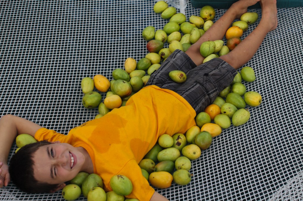
Boys gather 92 mangos (green)
The boys went on their own hike to gather mangoes, and they came back with 92
Email to family and friends dated May 9, 2014
Subject: Anaho
We made it to Anaho and it’s one of the loveliest anchorages we’ve been in, well worth the bash to get here. Unfortunately, it’s been raining all day today (Thursday) so we haven’t been able to fully enjoy it. We are down to just a day or two left in the Marquesas, so it’s a bit disappointing. On the 6 or so mile trip to get here from Hakaehu, Lady Carolina landed a huge wahoo. We were on the radio with them, and Steve was telling us to go ahead and pull in our lines since we are set for fish for a while and then… whrrrrr…. fish on! Tim also wrestled aboard a 5.5 ft wahoo. So, now we are REALLY set for fish. We have traded some with some locals for bananas (although the bananas have not arrived yet), traded some to another boat for some dorado, and given some away to another boat we’ve seen several times previously at other anchorage. We had a HUGE wahoo dinner on Lady Carolina last night, and we’ll be having another on Exodus tonight.
Tim, Steve, Carolina, and I went on a hike this morning (sans kids) up over a ridge to the next bay where there is a town and we heard you can get baguettes there. It was a long hike, and I enjoyed it because it gave me that same feeling I get from running (getting the heart rate a little bit up and then just pushing along). We scored some baguettes but they were frozen and since it was such a small town we tempered our desire to buy 8 each and cut it down to 4 each.
We will likely leave for the Tuamotus on Saturday and we will hook up again with True Blue V for the passage, so we will be convoy of 3. Chara is already in the Tuamotus but hopefully we will catch up to them in Tahiti if not before.
Love and miss you all,
-D.
—–
At 5/6/2014 3:25 PM (utc) our position was 08°49.34’S 140°03.89’W <—- just noticed the date and time are wrong. Not sure why… it’s currently Th May 8 4:50 pm Marquesan time (UTC – 9.5)
P.S. I have discovered a process error which has caused many of the dates attached to these location messages to be erroneous. Anyway, since I do these manually, it’s best to take them with a grain of salt. The best way to check our location is on the inReach page.
Email to family and friends dated May 10, 2014
Subject: Adios Marquesas
We are planning to leave Anaho around noon today (Marquesan time) for the Tuamotos. Our planned first stop is the atoll of Raroia, and we expect it to take between 3 and 4 days. We want to arrive on the lee side of the atoll where the pass is by Wed morning in order to make it through the pass at slack tide around 12:30. We’ll have the inReach on so you can track our progress and I’ll send another email if any plans change. Right now Tim is trying to find a leak in our dinghy and I just finished preparing passage food and I’m doing all the other pre-passage activies (testing EPIRB, getting sails ready, etc.) The boys changed the water maker filters and cleaned the sea water strainer and are currently trying to talk me into having the day off from school. They took yesterday off to go on a hike with Kyle and Joel to collect mangoes, and would you believe they came back with 92 nice green ones? We are trying to take extra fruit to the Tuamotus, because unlike the Marquesas it is not very abundant and we want to share with the locals. Tim, Steve, Carolina, and I hiked over to an organic farm yesterday and picked our own green beans, lettuce, radishes, and eggplant, and we also got some tomatoes and peppers that were already picked. The part of the hike back that was along a trail just off the beach was amazing and I regret I didn’t have my camera with me. White sand, blue water contrasted with dramatic black volcanic boulders. No, it wasn’t a quick trip to the store for veggies, but it was a journey worth taking.
Love and miss you all,
-D.
—–
At 5/9/2014 1:57 AM (utc) our position was 08°49.34’S 140°03.89’W
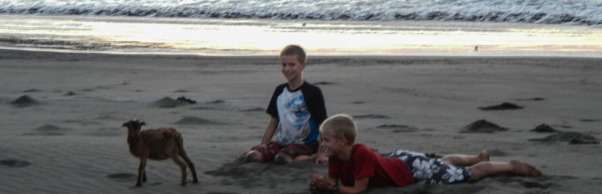
Unfortunately, I didn’t take many photos here. We met a father and son who treated us with such hospitality, including a tour of their property, a meal to share, and a bunch of pamplemousse. The animals in these photos are theirs.
Logbook – May 5, 2014 (Daniel’s Bay to Hakaehu)
Passage Log Highlights:
0928 Engines on
Depart
1002 Engines off main + genoa
1107 SB engine on + main
1258 P engine on + main (1 reef)
1425 Arrive Hakaehu
Daily Notes:
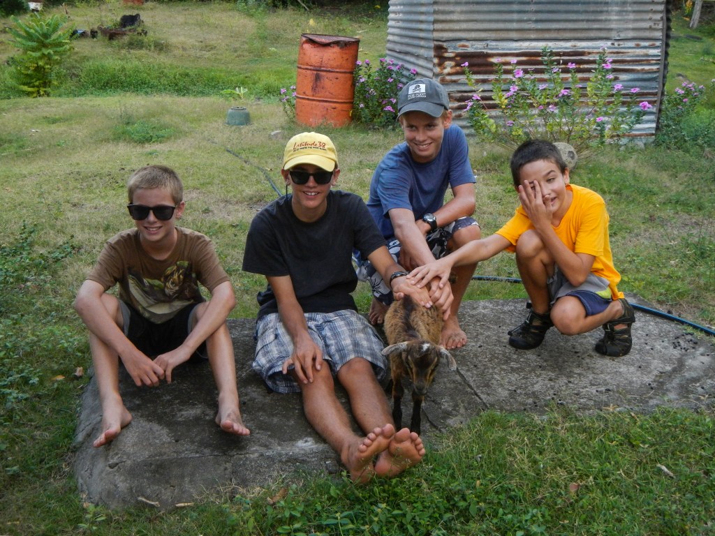
Met Albert and Germain – many animals (baby pig & goat!)
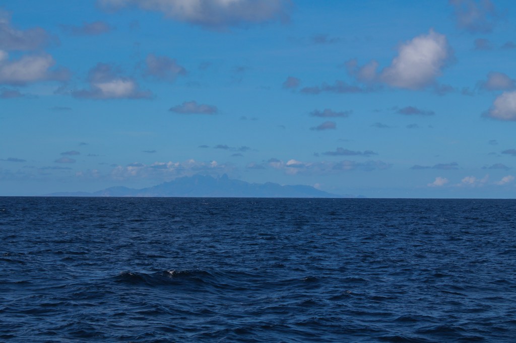
The view of Ua Pou as we traveled from Daniel’s Bay to Hakaehu. This island wasn’t in our itinerary, but we viewed it from afar.Depart Daniel’s Bay May 5 at 0928 – Arrive Hakaehu at 1425HakaehuBrenden loved all the baby animalsPiggie!!!Just playing with a baby goat on the beach…
Logbook – May 6, 2014 (Hakaehu)
Daily Notes:
T – help fix LC main sail
T/Steve – spearfish. T – lost bolt (gun broken) Steve – afraid of sharks
Dinner w/ Albert & Germain. Pig, breadfruit, breadfruit puree
Email to family and friends dated May 6, 2014
Subject: Hakaehu
Once again, we tried to navigate east around the north side of an island and got slammed with 20+ kt winds on the nose and didn’t make it to our destination. We heard this island (Nuku Hiva) was better. We heard that the wind funnels through the valleys and if you stay close to shore, you’ll get a nice beam reach on your starboard side. We heard wrong. Anyway, we didn’t make it to Anaho yesterday, instead we stopped at a less visited bay called Hakaehu. We won’t be leaving for Anaho today either, because we are in for another treat today. Tim met two guys, a father and son, who live here, and they showed us around their property where they harvest copra and grow many other fruits (they gave us pamplemousse and papayas) and they have many animals. Brenden especially enjoyed the baby goat that followed him around. They speak only slightly more English than we do French, but with a little bit of gesturing and had signals we were able to communicate. Today they have invited us to a meal with them where they are going to cook up a wild goat they caught (we actually saw it tied to a tree yesterday). I wish I had more bananas right now because at our last meal with Marquesans on Tahuata the banana bread was about the only thing we brought that they liked. Maybe I’ll make pumpkin bread (I’m sure I have a can of pumpkin rolling around somewhere). I will also be sure to bring my French book this time.
Love and miss you all,
-D.
—–
At 5/6/2014 3:25 PM (utc) our position was 08°47.27’S 140°10.89’W
Baie de Taioa became known as Daniel’s Bay because of after a Marquesan couple, Daniel and Antoinette, who lived there for a very long time and were quite welcoming to cruisers. Thanks to the TV show survivor, which used this bay as the set for one of their seasons, they no longer live here, but we enjoyed our stay none the less. The highlights were a hike to yet another waterfall, and our first taste of Wahoo, courtesy of Tim and Steve.
Logbook – May 2, 2014 (Taiohae to Daniel’s Bay)
Passage Log Highlights:
1027 Depart
1041 Port engine off
Port engine on
1154 Arrive Taioa (Daniel’s Bay)
Daily Notes:
*Speedo didn’t work the whole way
T/Steve dinghy fishing. Wahoo! Tuna! Dinner on Exodus with LC
Depart Taiohae May 2 at 1027 – Arrive Daniel’s Bay at 1154Daniel’s BaySara MWahoo!Wahoo Tuna!
Email to family and friends dated May 2, 2014
Subject: Daniel’s Bay
After several days of provisioning and internet we finally made it a few miles out of Taiohae to what it commonly called Daniel’s bay. There used to be a Marquesan here called Daniel who would befriend cruisers, but those of you who watch Survivor might recall that when they filmed Survivor Marquesas this is where they did it and they paid Daniel to move and tore down his house. (At least that’s the story I heard at one of the seminars I went to). We’ll stay here a couple days, enjoy another hike to another spectacular waterfall, and then decide if we will visit one more anchorage here on Nuku Hiva before we leave the Marquesas for the 3-day passage to the Tuamotus.
Love and miss you all,
-D.
—–
At 4/25/2014 3:54 PM (utc) our position was 08°56.60’S 140°09.81’W
Logbook – May 3, 2014 (Daniel’s Bay)
Daily Notes:
Potluck on Exodus more fish – wahoo & tuna
Email to family and friends dated May 3, 2014
Subject: Wahoo!
Daniel’s bay is nice and sheltered, so it’s one of the least rolly anchorages we have been in, but the best part so far was the WAHOO!! Tim and Steve went dinghy fishing yesterday afternoon and came back with a 4.5-5 ft. Wahoo. And for good measure they also caught a good size yellow fin tuna. So, we at very well last night.
Love and miss you all,
-D.
—–
At 4/25/2014 3:54 PM (utc) our position was 08°52.85’S 140°02.88’W
Logbook – May 4, 2014 (Daniel’s Bay)
Daily Notes:
Hike to waterfall & pool. Boys swim. GoPro video.
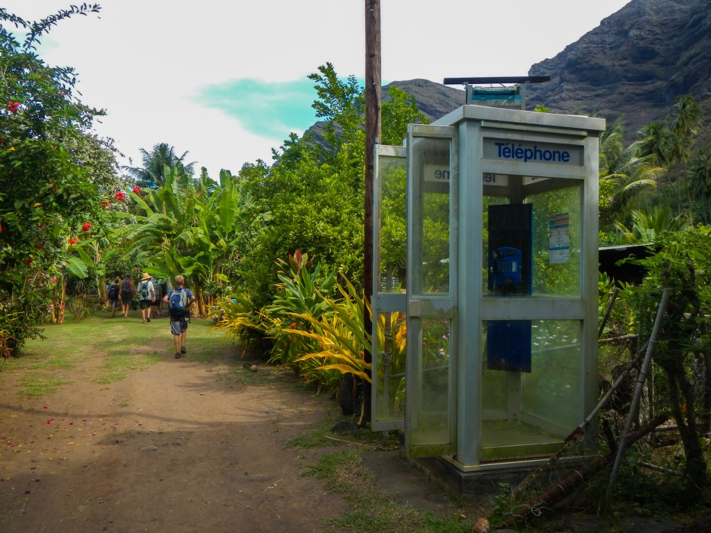
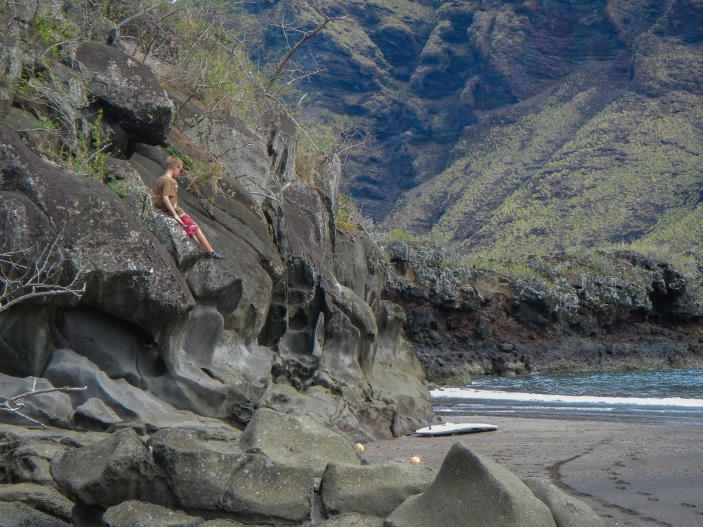
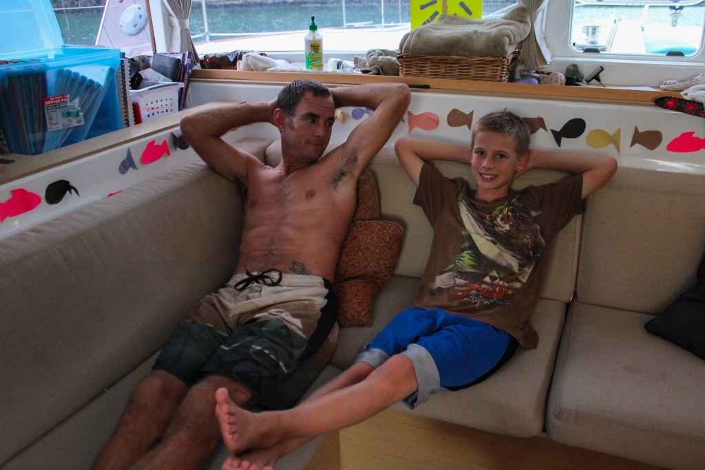
Shore excursion to see a waterfallBrenden’s superhero poseThere are phone booths in the strangest places.Tim has a mini-me.
This is actually an excerpt from an email sent out by Steve from Lady Carolina. He writes much more than Tim, so he’s given me permission to include things like this when he describes things he and Tim do together.
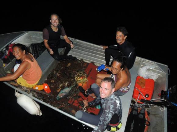
On a completely different note: Catching Lobsters. To tell you the truth, I am not much of a lobster coinsure, I can take them or leave them however Kyle and Carolina LOVE them. This means that we go lobster fishing every now and again.
There are several methods of catching lobsters. One, you dive during the day and look for their antenna sticking out of rocks, you then dive down and spear them in the face with a pole spear, drag them out and put them in a dingy. There are a few problems with this method. Firstly, they really do not want to be found and tend to hide really well during the day. Tim and I have dove on reefs for hours and never saw any signs that there were lobsters there. At night on a full moon, just before the moon rises however, they do come out a bit more and are easier to spot.
Secondly, when you stab a lobster in the face it’s pretty much game over for them and it is difficult to tell the sex before you stab them. Also, during the stabbing process the lobsters have a bit of a freak out (understandable) make a lot of noise and flop around violently. Freaking out, making noise and flopping around are the top three items on any shark’s ToDo list. In other words, spearing lobsters attracts sharks.
So, what Tim and I do is dive a night with flashlights. Search around for them clinging to walls or moving from den to den (they are surprisingly hard to see and are camouflaged very well) then you sort of gently swim up and try not to disturb the water around their antenna. If you do, they are gone. Right now. Amazingly super-fast. If you touch their antenna? Gone. It is quite a sight to see how fast they go from zero to out of grasp to out of your view.
We dive, locate and grab them. (The big ones take two hands to grab, and you seriously have to use your feet to pull them off the rock after you grab them.) After we have them secure in our hands, we straighten the tail to see if it is a male or female. Females we let go, males, well, sometimes it’s hard to be male. Bring them to the surface and put them in the dingy. Typically, 2 divers down and one person in the dingy floating along close to the rocks.
Oh, yes. And wear gloves, thick gloves. Those prehistoric spiney spear defenses they have are certainly painful……even with gloves if you grab them the wrong way!!!