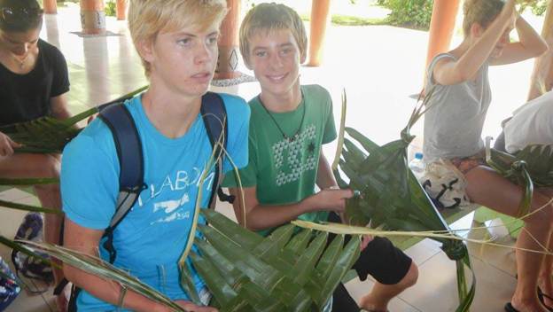
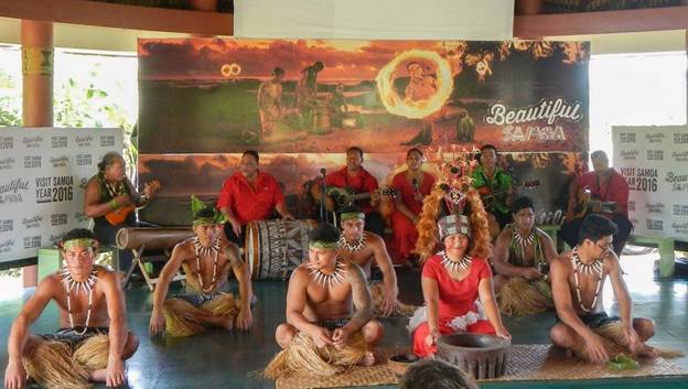
I made the boys go with me to a “cultural show.” They grumbled a lot, but when I told them it could count as school for the day, they were a little more agreeable, although nowhere near enthusiastic. Tim and Emelie and Fred weren’t interested in doing something so touristy. When you’ve already spent so much more authentic time in the island culture something like this geared towards regular tourists can seem pretty lame. But I was thinking, “well it’s free, and maybe I’ll learn something I didn’t know.” And wow, it was great. It’s funny because we’ve done/seen all of the these things already: cooking in an Umu, tapa making, wood carving, Polynesian dancing, but at this show they gave us a very detailed step by step demonstration of these things, and it was an opportunity to bring together in one linear flow all of the individual tidbits we’ve learned piecemeal along the way. And it was a forum to ask all of those lingering stupid questions. However, the highlight was something we haven’t seen before… traditional tattoo artistry (where they tap tap tap the cutting tool on your skin). We also learned that Samoa has their own version of a Kava ceremony (like in Fiji). Similar but different.
The host was knowledgeable and charismatic, and it was pretty classic when he was talking about “Samoa Time” and that if you have an appointment with a Samoan, they will most likely be late and Brenden pipes up that, “it’s like that in all the islands.” I thought the guy was going to give B a hard time about what makes him such an expert, but he let it slide. He talked proudly about how Samoa was the first of the Pacific Islands to achieve independence and that they helped pave the way for other island nations to follow. I didn’t bother to point out that since Tonga was never colonized and they were always independent that technically they should be considered first.
The boys were so happy to be there! They taught us how to make the plates out of palm fronds, but of course we knew how to do that already. Brenden told me, “Victoria taught me that a long time ago…”
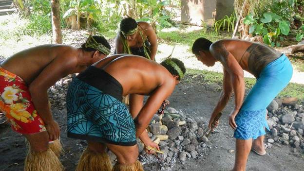
The men preparing the Umu
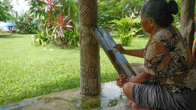
Tapa making… here she is using water and a shell to thin and flatten the bark (of a paper mulberry tree).
Getting ready to demonstrate the Samoan “Ava ceremony” The purpose of the ritual is similar as to Fiji, to formally welcome visitors, but many of the details are different.
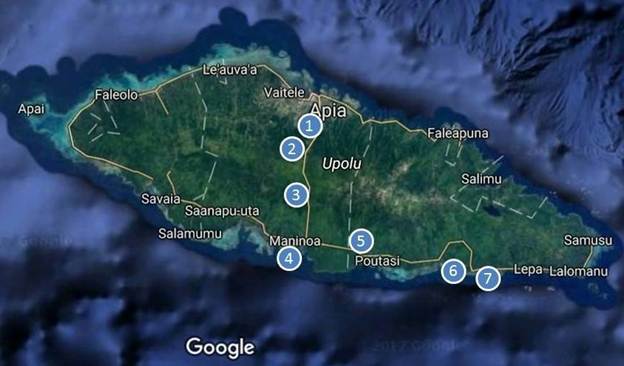
We got a little bit of the tourist bug, so we ended up doing some land touring, which is something we hadn’t done since we were in New Zealand. We paid a taxi driver a couple hundred bucks to take us around the island of Upolu to see some of the popular sights. There were many options, but we ended up narrowing it down to the following itinerary:
Our island tour itinerary
Villa Vailima – The Robert Louis Stevenson Museum
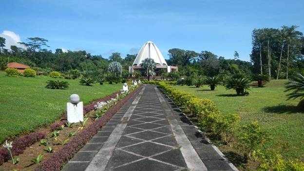
The Baha’i Temple
Papapapatai Waterfall
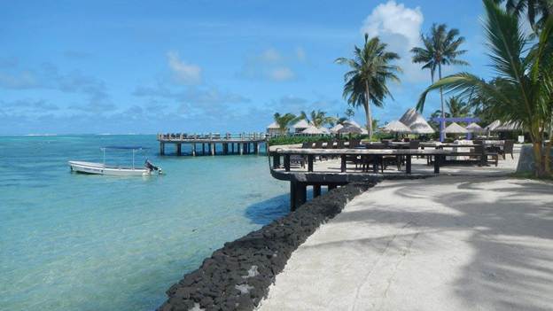
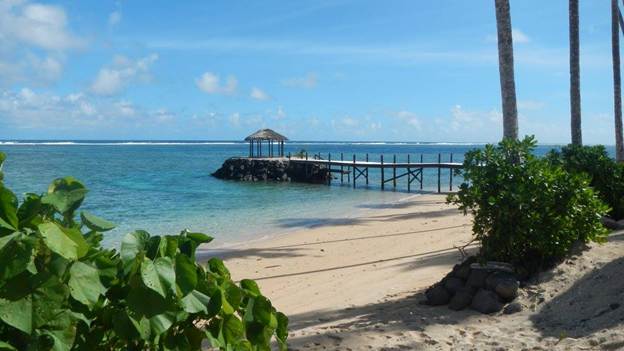
Coconut Beach Club
Togitogiga Waterfall
Saletoga Sands Beach
Resort (for lunch)
To Sua Ocean TrenchVailima = carry water in your hands
Taula, our taxi driver and tour guide, was talkative and friendly, and clearly knew his way around. He must not have been used to taking cruisers around though, because we told him we were more interested in seeing villages than resorts, but he took us to resorts anyway.
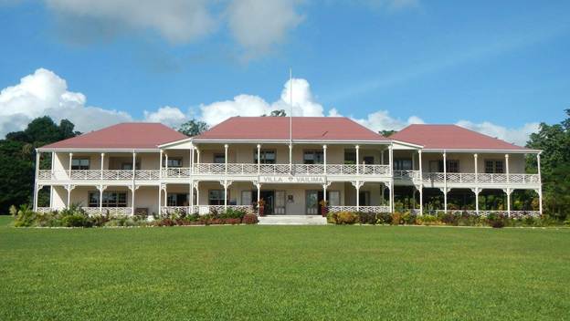
Villa Vailima is The Robert Louis Stevenson Museum, but it’s actually much more than that. It’s actually the preserved house that he and his family lived in during their time in Samoa. With this stop we could count the day as a school outing, since Brenden was reading RLS poetry and was about to start a non-fiction book about his travels across America on an immigrant train. RLS had a stepson named Austin who here when he was 8, and he was homeschooled and then he returned back to the U.S. when he was 12. So, I suspect he and Brenden would relate about a few things.
Robert Louis Stevenson’s house
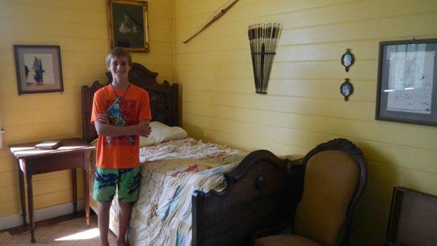
The bedrom of RLS’s step-son, Austin
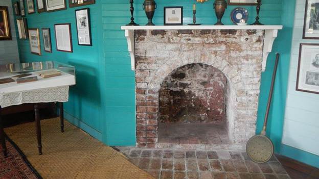
There are two fireplaces in RLS’s house, and these are the only two in all of Samoa. Of course they are, it’s freaking hot here! But it turns out these are just facades anyway to give them the feel of home. There aren’t even chimneys
Since there are only 8 Baha’i Temples in the world and it was on our way anyway, we decided to take a peek. To me Baha’i seems to be an interesting alternative to the other monotheistic faiths, but it still has all the trappings of a religious organization. The monk inside who talked with us was gentle and courteous.
The Baha’i Temple near Apia
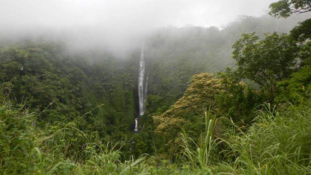
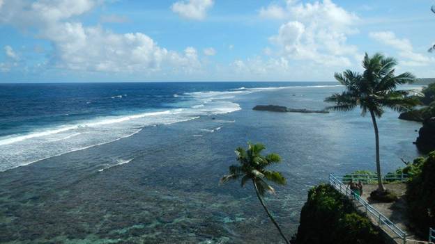
When we stopped at Papapapatai Waterfall and got out and walked around, the lush green scenery reminded me of being in Hawai’i, and to be honest it was every bit as beautiful. It was damp and foggy, but we were still able to enjoy the view.
A foggy view of Papapapatai (that’s two papas) Waterfall
Coconut Beach Club. All we did there was walk around.
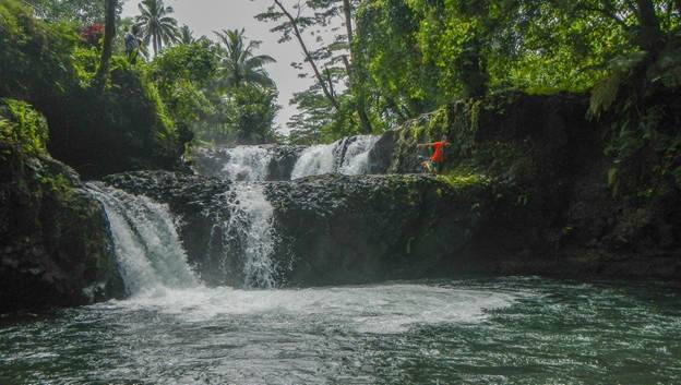
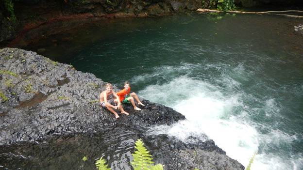
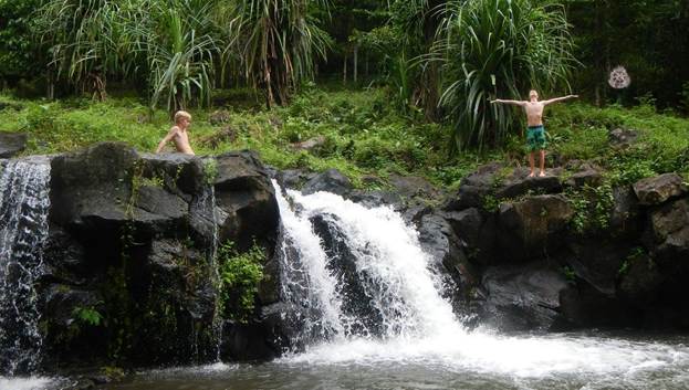
The Togitogiga Waterfall was *way* more our style. Brenden was the first in the water, big surprise, but the time we left even I had jumped in.
The Togitogiga Waterfall -Brenden was the first one in
The Togitogiga Waterfall
Saletoga Sands Beach Resort – where we stopped for lunch
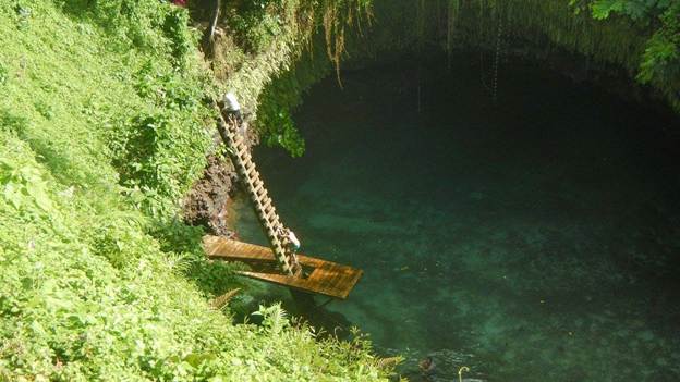
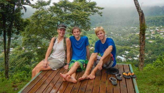
The last stop of the day was the To Sua Ocean Trench, and it was definitely the highlight. The entire property is beautiful, and the market it for weddings and such. But the main attraction is a 30m deep swimming hole that is fed from the ocean through a cave.
Tim and Brenden made their way down first, but eventually I made my way down too. Alex was a bit grouchy, at least at the time I thought it was grouchiness, and he just hung out in one of the fales above. I chose to swim around the area you see in this photo below while Tim and Brenden went through the underwater tunnel leading out to the ocean. Of course they did.
Brenden had a lot of fun, but more than once he wished out loud that his boat kid friends were with us. “Then it would be really fun!”
Tim and Brenden climbing down into the trench
The view from the To Sua grounds
The drive back to Apia was a couple hours long, and sometimes quite winding. This was how we found out that Alex wasn’t grouchy, he was actually sick. Taula made an emergency roadside stop and just barely missed a huge mess in the back of his car. We weren’t sure if it was something Alex ate or if he was just carsick, but he was fortunately pretty much fine after that.
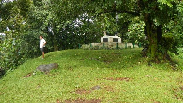
A few days after our tour we took a taxi back up to Villa Vailima in order to hike up to RLS’s grave. It wasn’t a long hike, but it was basically straight up, and because of all the rain it was muddy and slippery. That didn’t slow down Brenden, though. He made it to the top in 10 minutes. Barefoot. I brought up the rear, and it took me 25 minutes. In my running shoes. At the bottom of the trail is a waterfall and swimming hole, so we all had a chance to cool off for a while.
The grave of Robert Louis Stevenson
We made it to the top! The view from the gravesite of RLS.
Playing in the swimming hole at Villa Vailima
We decided to walk home, but that ended up being a poor choice because we got caught in the rain. We pressed on with our sights set on a yummy pizza launch at Giordanos. When we finally made there all soaking wet we hung our heads to find out they were closed until dinner. So, we caught a taxi back to the marina and foraged on Exodus.
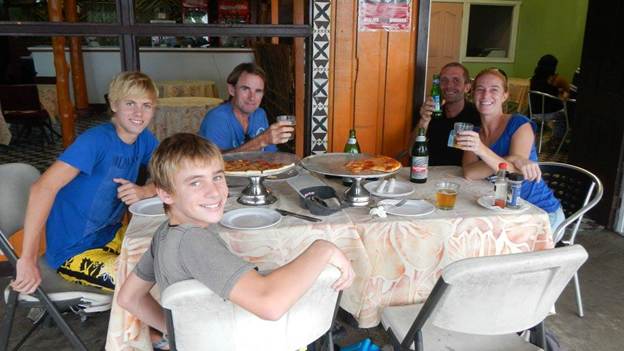
We returned to Giordanos that evening for dinner with Emelie and Fred from s/v Nefertiti and had a great evening with great food and company.
Staying in a marina has its pros and cons, but since we so seldom stay in marinas when we do we have a tendency to focus more on the pros than the cons. It’s nice to have access to dock water for cleaning and showering and it’s even nicer to be able to just step off the boat when you need to go somewhere rather than having to dinghy to shore or get a ride.
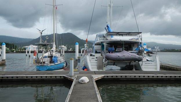
The marina was small, and Exodus took up an entire slip. Since we were there well in advance of the cruising season rush, it was sparsely populated and rather quiet. There were two other sailboats there with liveaboard cruisers and two pretty much abandoned vessels.
Nefertiti and Exodus snug in their slips after Cyclone Amos
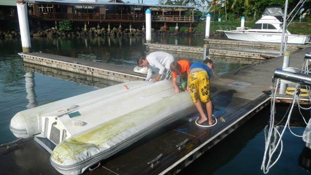
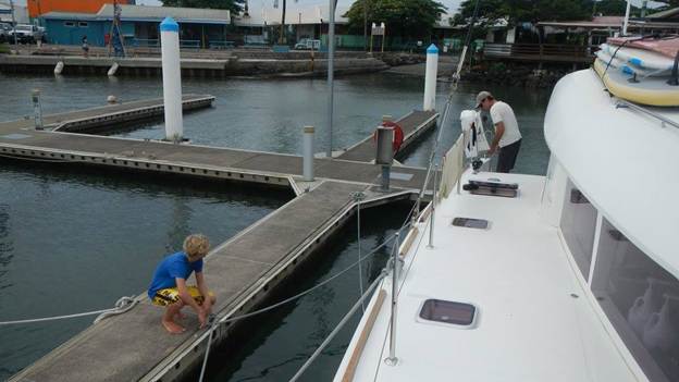
Giving the dinghy a good scrubbing at the dock in Apia
Apia turned out to be the right place at the right time for us. After the much more remote cruising we did in Tuvalu, Kiribati, and Marshalls, Apia was a wonderful change of pace. It is a large enough town to have the best amenities since New Zealand but not so big to be industrial and dirty. It’s bigger than Savusavu, but smaller than Suva. Bigger than Neiafu but smaller than Nuku’alofa. The people are very friendly, which made it fun to just walk around town and explore.
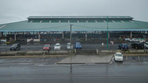
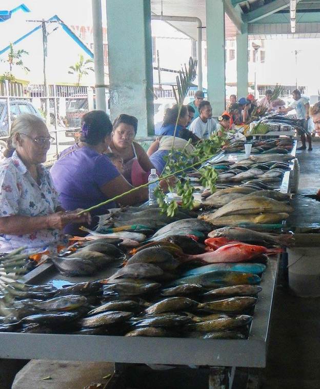
The marina is on the opposite side of the harbor from the downtown area, and it was a good mile walk around the edge. Usually when running errands, I would walk down there and then take a taxi back, especially if I was loaded down with provisions. Taxis were plentiful and reasonably cheap, although there was a standard fare and you had to be careful not to get overcharged by making sure you had an agreed to price before taking the ride. Provisioning was excellent. Here are my notes from the small notebook I carried about with me: “Red mall (Chan Mow) – good cheese, coffee beans. Frankie – tortillas, roti, old-fashioned oats, chocolate. Lucky Foodtown – best meat and produce. Farmer Joe – Capt morgan, good wine selection.” It was rare to be in a place where there was a single store that met all your needs, and Samoa was no different. There was also a fish market near the water and a huge open-air market for fresh produce in and handicrafts in the middle of town. I bought the boys their own woven fans here, because they kept taking mine that I bought in Tarawa. There was a hardware store, a library, and even a movie theater where Tim took the boys to see Allegiant one evening. A real treat was not having to handwash all the clothes! There was a laundry place within walking distance of the marina, a little far to carry a bunch of bags, but I would usually take one of my big strong pack mules with me.
One of my favorite parts about being in Apia was running. It is easily my favorite place for a run in the whole South Pacific (excepting obviously New Zealand, since it’s not so hot there). The walkway around the edge of the harbor is perfect for running, and the best part was that there were always locals out running too, both men and women. So, instead of the strange looks I usually get when I’m out for a run, I’m getting smiles and greetings from all my fellow Samoan runners.
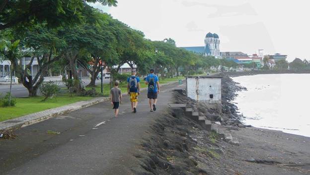
Walking to town along the edge of the harbor
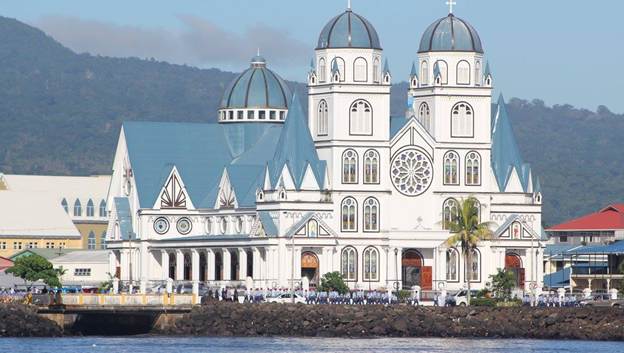
The Catholic Cathedral in Apia.
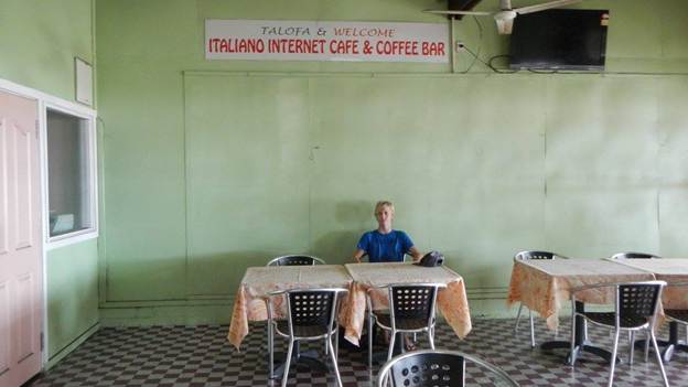
Italiano’s is neither an internet cafe nor a coffee bar, but the pizza and beer were good
A shot of the open air market in the rain
The Fish Market. They are keeping the flies off the fish.
We arrived well after dark on Wed April 20 and spent the first night anchored in the harbor near a big cargo ship. In the morning after several radio calls to Port Control, we were given permission to proceed to the marina, where there were two other boats and plenty of hands to catch dock lines.
All of the officials came to the boat to process us except immigration. We had a slight hiccup with Customs, though. Upon reviewing our outbound clearance from The Marshalls and after making a phone call back to the office, the customs official informed us that we would need to go to the office for an interview, because Tarawa, Kiribati was listed as the next port on our paperwork. We had no idea how big or small an issue this could be, but figured it must happen all the time to cruisers when plans change en route. So, we left the boys on board, and Tim and I walked down to the office. The interview was painless, but Tim was a little too chatty for my taste. In situations like this you need to just answer the questions that are asked and not offer any extraneous information, because you never know what could come back to bite you in a foreign country. Tim tends to believe that if you are just nice to people nothing can go wrong. Anyway, they let us stay without any fine or penalty.
Next was a taxi ride downtown to the immigration office. We had a short wait and our taxi driver waited for us and then gave us a tour of the town making sure to point out the popular shopping spots. He also took us to the telecom store to get hooked up with 3G internet access. We relaxed briefly at The Edge Cafe having snacks and drinks before becoming completely consumed for the next two days with monitoring and preparing for Tropical Cyclone Amos. My last post was all about that drama, and you can catch up with it here: Link.
Two years ago, when we were dragging anchor all around Pago Pago (American Samoa) our friends in Apia were having a great time. So, we are glad to get a second chance in this corner of the world in order to get our turn in this beautiful country.
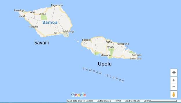
First things first. It’s “Samoa” not “Western Samoa.” They dropped the “Western” back in 1997, but many charts and maps still reference the old name. It’s a beautiful young reef fringed volcanic island nation with a lush green landscape and a rich history. The two largest islands are Savi’i to the west and Upolu to the east.
We spent two weeks on the island of Upolu, and one thing that really stood out to me was this: The Samoans have got to be the friendliest of all the Polynesians! And we’ve been to Hawaii, French Polynesia, Tonga, Atearoa (New Zealand), and Tuvalu. Seriously, they rival the Fijians for their friendliness!
Map of Samoa
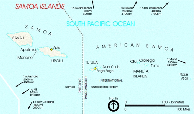
Samoa is part of the larger Samoan Island chain, and today it’s proudly referred to by the locals as “Independent Samoa.” While it’s sister Samoan nation of American Samoa remains a U.S. territory, Samoa (still Western Samoa at the time) achieved independence from New Zealand back in 1962. Western Samoa was first colonized by Germany near the turn of the century but during WWI it was occupied by New Zealand without German resistance. After the war it stayed in the hands of New Zealand until eventual independence.
The superficial differences between American Samoa and Samoa are easily spotted in that one has an American influence (so they drive on the right side and write their dates month/day/year) and the other has a Commonwealth influence (so they use A4 size paper and call trash cans rubbish bins). However, there are deeper differences, of course, due to the divergence of their histories and the way they are being governed today. American Samoa has become basically a welfare state while the people of Samoa must work harder for what they have, but I think there’s something to be said for hard work and independence, no? Of course, things like infant mortality rates are much better in American Samoa, and it’s hard to complain about something like that.
In any case, they are all Samoans, and even though they are politically divided they still share a kinship and rich history and culture.
The capital “city” of Apia on the north side of Upolu is one of the nicest in the Pacific, and the country has a developing tourism industry. It would make a great alternative to the standard Hawaiian holiday for anyone looking for a bit more ruggedness and a bit more access to traditional culture.
If you are interested in reading about our previous adventures in Pago Pago, American Samoa, including massive anchor dragging drama, here’s a link.
The greater Samoan Island chain including Samoa and American Samoa
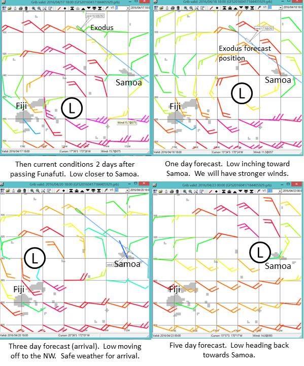
We had been on passage for five days when we were approaching Funafuti, Tuvalu, and we studied the weather forecast in order to decide what to do. Our ideal destination would be Samoa, since we ultimately wanted to get to Tonga in order to haul out Exodus for some new bottom paint and overall TLC. (If you missed the last post about the overall passage from The Marshall Islands back down to the southern hemisphere you can catch up on that narrative here: The Passage South. It sets the stage a bit for this post about TC Amos.)
Weather forecast when we decided to bypass Funafuti and press on to Samoa
We thought we were looking at a weather gift from the gods (shown to the right). A low pressure was forecast to move west to east over Fiji before moving back off to the west and dissipating. In the southern hemisphere low pressures circulate clockwise, so this meant we could ride the top of the low with moderate NW winds on the stern almost the whole way to Samoa. Winds would eventually die and shift south which likely meant some motoring on final approach, but we would take it. If we stopped in Funafuti and the SE trades filled in, it could be a long wait before a weather window opened up again in order to head SE from Funafuti to Samoa. And even if a window opened, it could be a marginal one with a lot of upwind bashing. So, we waved to Funafuti (and our friends who were anchored there) as we passed by and changed the logbook to read, “destination: Apia, Samoa.” (Note: All of the forecasts in this post are shown in UTC. For reference, local time in Apia Samoa was UTC +13 hours.)
We understood that the decision wasn’t without risk. Being mid-April, it was the tail end of the South Pacific cyclone season, and we had already had extensive experience with how weather forecasts were notoriously unreliable beyond 2-3 days. So, we understood that there was always the chance the low pressure could strengthen beyond the current forecast and/or take a different track. We decided that we would download weather every 6 hours and if the forecast warranted, we would stop heading south or even head up to the NE to Tokelau.
T minus 5 days: Press on
Weather forecast two days after passing Funafuti. Approximately three days away from Apia, Samoa.
For about a day and a half the forecast stayed somewhat favorable. However, on day two after passing Funafuti, we downloaded a forecast that gave us some pause for concern (shown to the right). In the one day forecast the low was inching closer to us, which meant that although our winds would continue to be from a good direction they would be stronger and the overall conditions would be more volatile and squally. And ultimately, we did see 25 kts sustained with regular squalls up into the high 30s. Then the low would move off to the NW which would give us light winds (but likely still squally conditions) for arrival. But instead of continuing to the West and dissipating it was forecast to turnaround and come straight back to Samoa in a few days.
So, what to do at this point? We were approximately 3 days out from Apia, so should we implement one of our backup plans and alter course or press on? A couple of specific things influenced our decision. First was the fact that although the forecast track of the low was to head to Samoa, the forecast severity was pretty benign: about 1003 mb at worst. Second was that if we altered course and stayed at sea, there was still the possibility that we wouldn’t outrun it, so we judged it far better to face a potential cyclone in port than at sea. If we were in port, we would still be putting Exodus at risk, but we would be putting ourselves at significantly lower risk than if we stayed at sea, because we would abandon Exodus before we ever put ourselves in danger. And Exodus was insured. And we were nearing the end of our journey, so although we would surely mourn the loss of Exodus should anything happen, certainly no dreams would be dashed. We had lived those dreams already. As I write this now, it makes perfect rational sense to me, but I have to admit that at the time of the decision, we didn’t give a whole lot of credence to the idea that we were really taking any big risk with Exodus. The forecast was for a weak low, and likely the forecast track would change 96 times and not end up coming to Samoa after all. What I’m trying to say is that at the time of making this decision to press on to Samoa, I hadn’t come to any sort of inner peace with the idea of losing Exodus. It was still an abstract concept and so unlikely as to not be worthy of giving any emotional investment.
T minus 4 days: No Turning Back Now
Weather forecast when we were about a day away from Apia, Samoa.
Over the next two days the forecast changed very little other than the strength of the low. Shown to the right is the forecast when we were about a day away from Samoa. It was still moving off to the West for just long enough for us to arrive but then would slam Samoa a few days after that. The two quadrants on the bottom show the same forecast, but the one on the right shows a higher resolution one that I downloaded to try and get a better perspective on the position of the low. At this point we had no other option but to press on and our only objective was to get there as soon as possible in order to prepare.
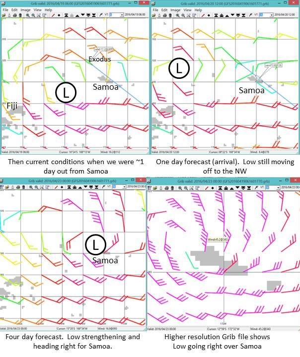
We arrived in Apia, Samoa at night on Wed, April 20 and spent the night anchored in the harbor. On Thursday morning we were granted permission to move to the marina, and then we spent most of the day clearing in, provisioning some fresh items, and getting internet access. And once we had internet access, we could monitor the storm’s progress much more easily.
T minus 2 days: Our Nemisis gets a Name
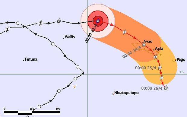
Forecast from 4/21 06:00 UTC (Thurs 7pm local time). Cat 1 Tropical Cyclone (TC) Amos forecast to strengthen to a Cat 2 and pass over Wallis and then veer to the SE
The chart to the right is for Thurs, 4/21 6:00 UTC, which was 7pm local time. The black line is the actual track and history, and the red line is the forecast. It shows that our weather gift from the gods that had given us a favorable wind direction for our passage had become a full-blown category 1 cyclone. It had also been given a name: Amos.
The chart also shows that Amos was forecast to strengthen to a category 2 and then eventually pass Samoa to the south. All things considered, it wasn’t a terribly concerning forecast if it held. We certainly weren’t panicking.
Forecast from 4/21 12:00 UTC (Fri 1am local time). Cat 2 TC Amos forecast to strenghen to a Cat 3 as it passes South of Samoa.
Just 6 hours later Amos was upgraded to a Cat 2 (chart to the right). The overall track forecast didn’t change but now it was forecast to be a Cat 3 when it passed Samoa. We still weren’t panicking, but we were definitely a little more concerned. I was obsessed with weather updates, and I decided to do some heavier provisioning, including getting all the propane tanks filled, just in case there were any infrastructure issues after the cyclone.
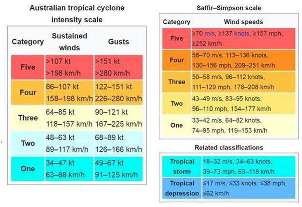
I should point out that when I use the cyclone category levels here, they might not be the ones you are used to, since different scales are used throughout the world. In the South Pacific, the Australian tropical cyclone intensity scale is used, which is different than the scale that’s used by the U.S. National Hurricane Center for hurricanes in the NE Pacific and Caribbean (Saffir-Simpson scale). You can see a comparison of the two scales below. So, when TC Amos was forecast to be a Cat 3, this meant sustained winds of 64-85 kt, which is roughly equivalent to a Cat 1 hurricane back home. It was only slightly comforting to tell myself that it wasn’t *really* going to be a Cat 3, it was *only* going to be a Cat 1.
Cyclone/Hurricane intensity scale comparison. Left: Australian Scale used for South Pacific cyclones. Right: Saffir-Simpson scale used for Hurricanes in the U.S.
T minus 1 day: The Preparation
We spent most of Friday getting ready. We moved Exodus to the middle of the slip and tied dock lines to all sides. This was meant to prevent bashing into the dock on one side, depending on the direction of the wind. We stowed as much as possible and covered the dinghy so it wouldn’t collect water. Our new neighbors at the dock, Fred and Emelie from s/v Nefertiti, spent the day doing much of the same. In the evening we had an impromptu happy hour on Exodus using a little socializing to calm our nerves and feel like everything was normal. They were just starting their cruising adventure having departed from New Caledonia towards the end of the cruising season hoping to make it to French Polynesia before cyclone season kicked in. But they ended up stuck in Samoa and could barely believe they had almost made it through the cyclone season only to now be threatened by Amos. I shifted my focus from concern over ourselves and Exodus to concern over them. We were almost done cruising, and Exodus was insured. They were just starting out, and it would be heartbreaking for their dream to be interrupted by the tragedy of a cyclone. They were still intending to head to French Polynesia with plans to be married there and spend time exploring (being French, they wouldn’t be limited to a 3-month visa!) Although shifting my concern to their situation felt good and altruistic, I’m sure there was something self-serving about it. Perhaps it was a bit of a coping mechanism.
Tim and Alex getting the dock lines just right.
T minus 18 hours: Shit Gets Real
It’s good we felt prepared, because by Saturday morning shit started to get real.
The chart below shows the forecast for 4/22 18:00 UTC (Sat morning, 7am local time.) Amos was already upgraded to a Cat 3 cyclone and was forecast to graze Samoa as a Cat 4 sometime Sunday night/Monday morning. Cat 4 means sustained winds of 86-107 kts. So, we are now talking about > 100 kts sustained winds! And the geometry almost couldn’t be worse. Cyclones rotate clockwise in the Southern Hemisphere and given the direction it would be moving as it passed us, we would be in the quadrant of strongest winds. And we would see sustained winds from the North and our strongest winds from the NW as it reached its closest proximity to us.
Forecast from 4/22 18:00 UTC (Sat 7am local time). Cat 3 TC Amos forecast to strenghen to a Cat 4 as it passes even closer to Apia, Samoa.
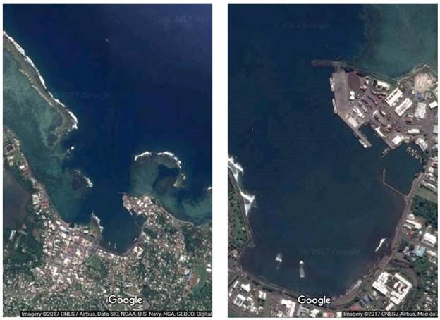
The reason this was so bad was because 1) Apia isn’t exactly a hurricane hole (understatement!) and 2) It’s wide open to the north. We were far less concerned about windspeed at this point and far more concerned about storm surge. The photos below show the geometry of Apia harbor, and you can see the small marina on the right-hand side. Sustained winds from the North to the Northwest would cause the seas to build and barrel straight into this little harbor. We had no idea how the docks would hold up with Exodus and all her weight and windage being blown by the gusts and tossed by the surge. It was important to make sure we had redundancy in the lines and that they were set for minimum chafe. Tim and Alex had already done this.
Apia Harbor is wide open to the North. In the close-up image on the right you can see the small marina on the right hand side.
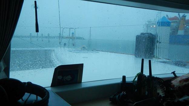
Heavy rain started Saturday morning, and the forecast only got worse.
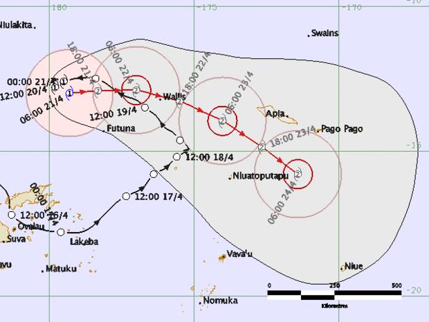
T minus 12 hours: A Direct Hit is Forecast
The chart below is from 4/23 00:00 UTC (Sat 1pm local time). It was hard to believe. Amos was now going to more or less pass right over Apia as a Cat 4 cyclone. Sustained winds 86-107 kts, gusts of 122-151 kt. We would still be in the quadrant of strongest winds, and there was just no bright side to look on. This was pretty much going to suck.
Forecast from 4/23 00:00 UTC (Sat 1pm local time). Cat 3 TC Amos forecast to strengthen to a Cat 4 as it passes pretty much right over Apia.
Tim and I didn’t talk about an evacuation plan. He is a natural optimist and an expert in crisis management, so crisis avoidance and back-up plans tend to fall in my wheelhouse. I packed a couple bags with stuff we would want to take, but just pretty much kept that activity to myself. We would leave Exodus well before it got dangerous. I recalled the people died in La Paz, Mexico during Hurricane Odile because they stayed with their boats too long. If any amount of storm surge came in and unsettled the docks, we would leave. I wasn’t sure where we would go, though, but there were concrete buildings at the marina, which should be safe as the storm blew over. I decided to pack some food too.
It was ironic. Over the course of our journey, we had travelled thousands of miles to avoid being in a hurricane zone. We had gone all the way down to New Zealand only to have TC Pam come visit us in Opua and now we had gone all the way up to The Marshalls only to arrive back just a little too early.
Dark skies and heavy rain on Saturday morning
T minus 6 hours: A Small Consolation
The next weather update gave us a bit of an uplift. The chart below shows the forecast at 4/23 06:00 UTC (7pm Sat local time). TC Amos was still forecast to pass right over Apia in roughly 18 hours, but the forecast was downgraded from a Cat 4 to a Cat 3. We had seen rain off and on all day with light to moderate winds from the East.
Forecast from 4/23 06:00 UTC (Sat 7pm local time). Cat 3 TC Amos forecast to remain a Cat 3 and pass right over Apia, Samoa.
We didn’t know it at the time, but Amos would pass by us much sooner than forecast and by the time we got the next weather update it would all be over. The wind started to pick up between 7-8 pm and by about 10pm it was up in the 30 kt range. The gusts became more and more violent, and Tim would periodically go out in the pouring rain and check the status of the dock lines. We didn’t keep the wind instruments on all the time, so we didn’t have a record of the highest wind speed that we saw that night, which is a bit unsatisfying because the highest gust I have recorded in the logbook is 35 kt. I’m certain we saw at least 50 (we had been on Exodus long enough, we knew the windspeed by the way it sounded blowing through the rigging). I don’t remember what time the lightning started but it was visible off to the NW and it was absolutely spectacular.
T minus 3 hours: I Can’t Sleep
I went to bed around 10pm, but I knew I wouldn’t be able to sleep. I started reading to keep my mind occupied hoping it would help me fall asleep, but not a chance. It was frustrating because at that point I thought we still wouldn’t see the worst until the morning and I wanted to be rested when that time came.
T minus zero: What!? It’s Over?
At some point after midnight, we experienced a total calm and then the wind shifted to the West.
Just after 1am Tim brought his iPad in to me to show me the updated forecast.
It was over.
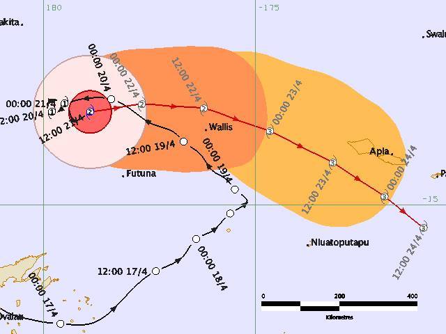
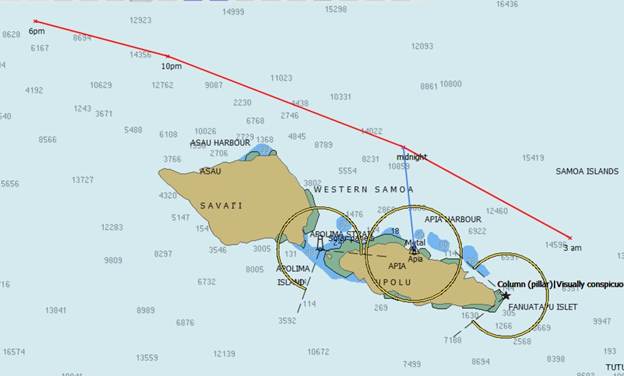
Amos had already passed us and had stayed north of us the whole time. Based on that geometry we had seen our worst winds from the SE, which meant the geometry of Apia Harbor protected us from the storm surge after all. We had drinks to celebrate and then slept like babies. I never did tell Tim I had packed a bag to evacuate.
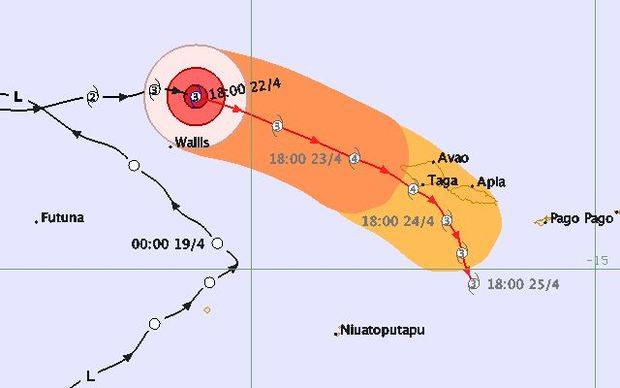
Below is the chart where I plotted Amos’s track as it passed us by that night. It was due north of us at approximately midnight and in the end, the center of the eye came as close as about 20 nmi as a Cat 3 cyclone.
Track of TC Amos
Time to Celebrate
We had a lazy Sunday morning and managed to talk with friends via SSB and let them know how lucky we were. In my enthusiasm I was screaming into the mike and only learned later that I had woken Emelie and Fred, but they cut me some slack because they of all people understood.
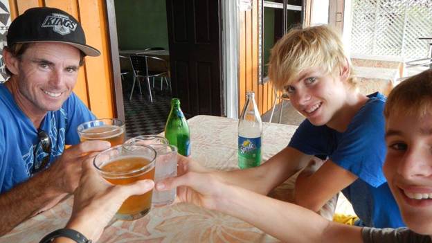
We ventured out in the afternoon to find some pizza and celebrate. Overall, Samoa fared well. There was some flooding and the harbor was muddy and littered, and I read there was some road damage, but nothing extreme and certainly no loss of life.
There was a pizza place right along the harbor that was open and we were the only ones there, and the beer and pizza tasted extra good.
Cheers to the cyclone slayers!
Fred and Emelie were walking back to the marina, so they joined us for our “We survived Amos” party.
The next post will be 100% dedicated to Cyclone Amos. It will be anti-climactic since, (spoiler alert) we and Exodus emerged entirely unscathed, but hopefully I can describe it as we expereienced it, without any sort of certainty that things would turn out the way they did.
After that I’ll get on with the business of chronicling our last few months in the south Pacific. We will visit some new places and also return to some old stomping grounds.
We didn’t make it before dark. And we had never attempted a nighttime arrival to somewhere we hadn’t already been. In anticipation, during the day we made contact with our friends on Iguana who had been to Apia before, and they reported that the harbor is easy to transit and they had made a nighttime departure there easily. We had satellite imagery so we knew precisely where the edges of the reef were, and we had made contact with harbor control who had told us exactly where we could safely anchor in the harbor upon arrival. It was still a bit unnerving going in, mostly because when you are at the helm navigating at night you typically use navigation lights to guide you, but the harbor navigation lights weren’t in the same location as indicated by chart, plus Apia is a large town so the background lights were distracting and made it hard to read the navigation lights. Anyway, we made it in safely, and here’s what I wrote about it at the time:
“We arrived at Apia, Samoa last night, and we kinda pulled a Lady Carolina in that we arrived just after dark, but instead of following LC’s cautious (smart?) ways we went ahead and entered the harbor and dropped anchor at night. I was livid because it was beyond my risk tolerance considering that we’ve never been here and we didn’t even know where we should go once inside the harbor. It helped that Port Control answered the radio and advised where we could anchor for the night. Later, once safely at anchor, I thanked Tim for being bold and confident enough to come in at night because sitting there drinking the last of my Zaya was a whole lot nicer than standing another night watch. His response was, “well, luck favors the bold…” Didn’t exactly bolster my confidence in our decision making, but the rum still tasted good. So, instead of pulling a Lady Carolina I guess we pulled a Skabenga (“We’re not staying the night out here, we’re comin in….”) although in fairness to us, Apia is a much safer place to enter at night than Raroia.
P.S. I don’t know if I’ve ever written about Skabenga, but they are our friends who entered Raroia, an atoll in The Tuamotus, after dark, and they are pretty much the poster child for “luck favors the bold.”
P.P.S. In case you missed the hint above, I am out of Zaya. So, someone needs to come visit.”
If you followed our trip at all, you know who Lady Carolina is. They just always seemed to have this knack of arriving just after dark… They *never* would have done what we did!
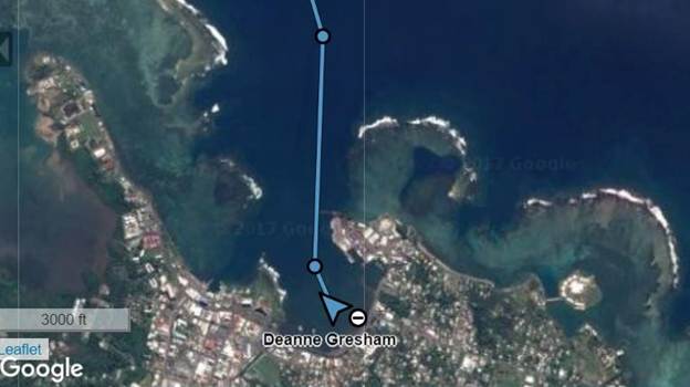
Apia Harbor (no we didn’t actually get that close to the Jetty…iReach only updates once/15 min and then drraws a straight line.)
We finally raised anchor just after noon on Monday, 11 April, and wouldn’t you know it, the SB engine started without issue.
The first day out was the polar opposite of the previous passage: instead of bashing upwind in strong winds trying to avoid squalls and getting pushed off course by the current, we were comfortably sailing downwind in light air hoping for squalls and getting pushed toward our course by the current. There are lots of log entries during the first two days of the passage, so clearly, I was feeling a lot better this time. We saw light winds for several days all from the NE to NW, so even though we were now down in the southern hemisphere, the SE trades had not filled in, which was good since that was the direction we were trying to go. We saw the occasional squall that would disrupt things a bit, because they would come with a wind shift to the SW, however, they wouldn’t come with much of a wind increase so we just altered course until the wind would shift back. Throughout these first days of the passage, I was looking forward to returning to Funafuti. In an email, I wrote, “ I am looking forward to the rarity of returning to somewhere we’ve already been, a place where I already know the best places to provision and where to fill propane. It’s a small thing, but I’m finding some comfort in it.”
On Day 6 of the passage, we decided to bypass Funafuti and continue pressing Southeast. You’d think since I had just been musing about looking forward to it, I would have been heartbroken. But here’s what I wrote at the time:
“Within sight of Funafuti, we made the decision today to keep going and try to get to Wallis or better yet, Samoa, with these N-NW winds. It wasn’t as hard of a decision as you might think… backing up a bit, when we left Fiji back in November it was with the idea that we would return in May to haul out and then possibly cruise Fiji a little more. But since then we’ve found out that we can’t actually haul out in Fiji, the boatyards can’t haul boats our width, which means they can’t haul catamarans… I know, we were shocked. So our options became Vanuatu or Tonga, and since Tonga is more centrally located to possibly be more attractive to a buyer, we’ve changed our plans to go back to Tonga instead. Now, for the quick South Pacific geography/weather lesson… It’s really hard to go Southeast, because that’s the direction of the trade winds, and Tonga is southeast of Tuvalu. I’ve been wondering for awhile now how we were going to manage to get to Tonga, and this morning, a weather window presented itself, and if we can get to Samoa we will be in excellent shape. There have been a family of weak lows, and we’ve been riding the top of one to get NW winds in order to sail downwind from Kirbati to Funafuti. Now it looks like we might be able to continue that approach, and hopefully we’ll make it as far as Samoa. So, that’s why it wasn’t a hard decision… who knows when/if another weather window would open like this again. Of course, I’m about to download weather now, and things change and the window could close on us and then we would have to follow one of my 96 contigency plans. Morale is surprisingly high on board considering that this morning we thought we’d be making landfall today and now we have 4-6 more days underway. I made two loaves of bread today, so I think that helped. My crew is pretty easy to please.”
Knowing what I know now, it’s hard to read this and not reprimand myself for this decision, because although I didn’t mention it at the time, it was a huge gamble. Cyclone season doesn’t officially end until May, and before leaving Kwajalein I had studied the pilot charts to understand the risk of an April arrival, and I had satisfied myself with the data although the risk was not zero, the chances of a late April cyclone were extremely, extremely low; So low that insurance companies don’t consider it cyclone season anymore, and we were still covered. However, at this point in the passage we were able to ride NW winds all the way down precisely because there was still cyclonic activity. I make mention of “a family of weak lows” and so we gambled that those lows would stay weak, but *spoiler alert* one of them most certainly doesn’t stay weak.
We were in sight of Funafuti when we decided to press on
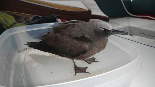
For the rest of the passage, the days all blend together. The wind steadily increased until we were running with a nominal 25 kts of wind on the stern and seeing more and more frequent squalls up in the mid to high 30s. Skies were consistently gray, and sadly Exodus became somewhat of a hospice care facility for small birds that must have been blown off course. Five total made their way to rest on Exodus, 3 died on board and 2 flew away after being startled (fate unknown). Tim would try to nurse them back to health, trying to get them to eat and drink, but I think by the time they got to us they were already spent. Needless to say, I was not the one who had to clean up all the poop. That was Brenden’s job.
This little guy didn’t make it through the night
On Day 10, the wind shifted so we couldn’t sail a direct course to Apia. There was a slight chance we could make it that day, so Tim wanted to engine up and head straight there. But I thought the chances were so slim we likely wouldn’t make it before dark anyway, so I proposed we tack NE and then sail straight into Apia the next day. We argued, but Tim was just done with this passage, and he was hellbent on doing anything possible to try to make it that day.
Trip Summary:
Hours underway – 9 days 14:29 hours
Log miles – 1129 nmi, Avg speed – 4.9 kts
Track miles – 1135 nmi, Avg SOG 4.9 miles
DMG – 1065 nmi, Avg VMG – 4.6 kts
Engine hours – P only 15:08 hrs, SB only 25:11 hrs, Both 12:09 hrs
We had travelled a total of 2022 nmi to get from Kwajalein to Apia with only two quick pitstops along the way, and we were SO happy to be there.